Toggle navigation
LMEC Home
Exhibitions
Georeferencing
Tools for Teachers
Collections
My Favorites
Sign Up / Log In
Search
Search the map portal
Map Collection
Map Collection
Map Sets
Search
Search
Search for
Search In
All Fields
Creator
Title
Subject
Place
Search All Digital Collections
Advanced Search
8586 Results
My Search
Start Over
More Like
commonwealth:0r96fq87q
Remove constraint More Like: commonwealth:0r96fq87q
Filter your Search
Place
North and Central America
5,881
United States
4,788
Massachusetts
2,052
Europe
1,359
Suffolk (county)
1,034
Boston
1,007
Canada
450
Asia
422
more
Place
»
Topic
Boston (Mass.)--Maps
577
United States--Maps
273
Real property--Massachusetts--Boston--Maps
174
Massachusetts--Maps
160
Landowners--Massachusetts--Boston--Maps
132
North America--Maps--Early works to 1800
106
New England--Maps
99
Europe--Maps
78
more
Topic
»
Date
Date range begin
–
Date range end
Current results range from
1482
to
2023
View distribution
Creator
United States. Hydrographic Office
594
O.H. Bailey & Co
148
Des Barres, Joseph F. W. (Joseph Frederick Wallet), 1722-1824
123
United States. Post Office Dept
120
Ptolemy, 2nd cent
100
Walling, Henry Francis, 1825-1888
94
Jefferys, Thomas, -1771
88
Geological Survey (U.S.)
86
more
Creator
»
Format
Maps/Atlases
8,527
Manuscripts
217
Prints
56
Books
36
Objects/Artifacts
10
Drawings/Illustrations
8
Posters
4
Georeferenced
Yes
871
No
7,715
Collection
Norman B. Leventhal Map & Education Center Collection
8,557
Boston and New England Maps
2,204
Urban Maps
1,936
Maritime Charts and Atlases
1,082
American Revolutionary War-Era Maps
641
Boston Redevelopment Authority Collection
87
Mapping Boston Collection
8
New York Public Library Collection
7
more
Collection
»
Available to use
No known restrictions
8,410
Creative Commons license
75
Search Constraints
Sort by relevance
relevance
title
date (asc)
date (desc)
Number of results to display per page
20 per page
10
per page
20
per page
50
per page
100
per page
View results as:
grid view
map view
Search Results
41.
Carte des environs du Fort Pitt et de la nouvelle province Indiana : dediée a M. Franklin
42.
A map of the seat of war in the southern part of Virginia, North Carolina, and the northern part of South Carolina
43.
Map of the western parts of the colony of Virginia
44.
Map of the western parts of the colony of Virginia, as far as the Mississipi
45.
MAP of the Western parts of the COLONY of VIRGINIA, as far as the Mississipi
46.
Noua Anglia, Nouum Belgium, et Virginia
47.
A plan of the entrance of Chesapeak Bay, with James and York Rivers : wherein are shown the respective positions (in the...
48.
To His Excellency Genl. Washington, Commander in Chief of the armies of the United States of America : this plan of the...
49.
Virginia et Nova Francia
50.
Belgii Novi, Angliae Novae, et partis Virginiae : novissima delineatio
51.
Carte de la Nouvelle Angleterre, New York, Pensilvanie et Nouveau Jersay suivant les cartes angloises
52.
Carte de la Nouvelle Angleterre, Nouvelle Yorck, et Pensilvanie : pour servir à l'Histoire générale des voyages
53.
Carte de la Nouvelle Angleterre, Nouvelle York, Nouvelle Jersey et Pensilvanie
54.
Carte réduite du nord des Etat-Unis avec l'intérieur du pays : pour servir à l'intelligence de cette histoire ; copieé par...
55.
A chart of the sea coast of New Foundland, New Scotland, New England, New York, New Jersey, with Virginia and Maryland
56.
An exact map of New England, New York, Pensylvania & New Jersey, from the latest surveys
57.
An exact map of New Jersey, Pensylvania [sic], New York, Maryland & Virginia, from the latest surveys
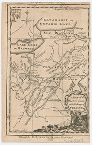
58.
Karte von Neu England, Neu Yorck und Pensilvanien
59.
A map of New England, New York, New Jersey and Pensilvania
60.
A map of Pensilvania, New-Jersey, New-York, and the three Delaware counties
‹ Prev
Next ›
1
2
3
4
5
6
7
…
429
430


![An exact map of New Jersey, Pensylvania [sic], New York, Maryland & Virginia, from the latest surveys](https://bpldcassets.blob.core.windows.net/derivatives/images/commonwealth:z603vp67m/image_thumbnail_300.jpg)


