Toggle navigation
LMEC Home
Exhibitions
Georeferencing
Tools for Teachers
Collections
My Favorites
Sign Up / Log In
Search
Search the map portal
Map Collection
Map Collection
Map Sets
Search
Search
Search for
Search In
All Fields
Creator
Title
Subject
Place
Search All Digital Collections
Advanced Search
68 Results
My Search
Start Over
More Like
commonwealth:05744q92c
Remove constraint More Like: commonwealth:05744q92c
Filter your Search
Place
North and Central America
51
Canada
50
New France
25
Quebec
20
Saint Lawrence River
18
United States
12
Québec
8
Province of New Brunswick
6
more
Place
»
Topic
New France--Maps
25
Seven Years' War, 1756-1763--Campaigns--Canada--Maps
21
Québec (Province)--Maps
19
Saint Lawrence River--Maps
19
Canada--Maps--Early works to 1800
8
Fortification--Québec (Province)
8
Québec (Québec)--Maps
7
Ontario--Maps
5
more
Topic
»
Date
Date range begin
–
Date range end
Current results range from
1752
to
1923
View distribution
Creator
Bellin, Jacques Nicolas, 1703-1772
8
Holland, Samuel, 1728-1801
7
Mackellar, Patrick, 1717-1778
7
Montrésor, John, 1736-1799
6
Collins, John, -1795
3
Duberger, Jean-Baptiste, 1767-1821
3
Sproule, Geo. F. (George F.), 1741-1817
3
Cook, James, 1728-1779
2
more
Creator
»
Format
Maps/Atlases
68
Georeferenced
No
68
Collection
American Revolutionary War-Era Maps
63
Library and Archives Canada Collection
52
William L. Clements Library Collection
10
Norman B. Leventhal Map & Education Center Collection
5
Boston and New England Maps
1
MacLean Collection Map Library
1
Available to use
No known restrictions
5
Search Constraints
Sort by relevance
relevance
title
date (asc)
date (desc)
Number of results to display per page
20 per page
10
per page
20
per page
50
per page
100
per page
View results as:
grid view
map view
Search Results
1.
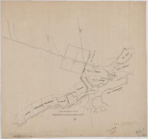
Proposed division line for Upper and Lower Canada
2.
By order of His Excellency Guy Lord Dorchester... plan of part of the province of Lower Canada containing the country from the...
3.
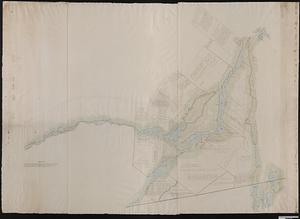
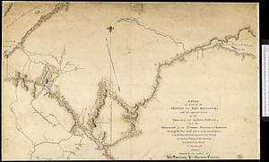
Plan of the west part of the province of Lower Canada from the R.r Sorel upwards, as far as any survey's hitherto been made
4.
Plan des terres de Abénaquis et Sokokis du village St-Francois situé dans le comté Buckinghamshire, district des Trois-Rivières...
5.
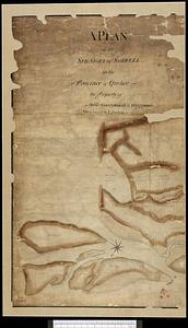
A plan of the seigniory of Sorrell in the province of Quebec the property of Messr Greenswood & Higginson, merchants in London
6.
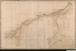
Plan of Canada or the province of Quebec from the uppermost settlements to the island of Coudre as surveyed by order of his...
7.
A plan of part of the province of New Brunswick, with the adjacent parts of the province of Lower Canada, and the territory of...
8.
Sketch of the Straits of St. Mary between Lake Huron and Lake Superior laid down from bearings of the principal points, and...
9.
Carte du gouvernement de Montréal
10.
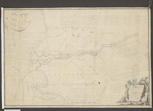
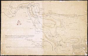
The Cedres
11.
Continuation of the Grande Riviere with the village of Fariole lying near Cape Torment on the north shore
12.
French draught of Lake Champlain & Lake George with remarks of an English prisoner who return'd from Quebec to Fort Edward by...
13.
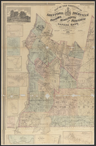
Map of the counties of Shefford, Iberville, Brome, Missisquoi, and Rouville, Canada East
14.
Map of the Eastern Railroad and principal connections
15.
A map of Upper and Lower Canada : with part of the United States adjoining, comprising the present seat of war
16.
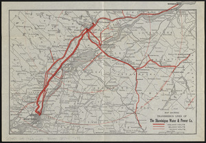
Map showing transmission lines of the Shawinigan Water & Power Co.
17.
A new map of the province of Quebec, according to the royal proclamation, of the 7.th of October 1763 : from the French surveys...
18.
North America : British provinces of New Brunswick, Nova Scotia, & part of Canada : compiled from recent surveys and adjusted...
19.
A plan of a rout from Fort Pownall on the river Penobscot in New England to Quebec and from Quebec to Fort Pownall : taken by...
20.
Sketch of different passes into Canada from our lower provinces
‹ Prev
Next ›
1
2
3
4