Toggle navigation
LMEC Home
Exhibitions
Georeferencing
Tools for Teachers
Collections
My Favorites
Sign Up / Log In
Search
Search the map portal
Map Collection
Map Collection
Map Sets
Search
Search
Search for
Search In
All Fields
Creator
Title
Subject
Place
Search All Digital Collections
Advanced Search
209 Results
My Search
Start Over
More Like
commonwealth:kh04p664d
Remove constraint More Like: commonwealth:kh04p664d
Place
United States
Remove constraint Place: United States
Filter your Search
Place
United States
[remove]
209
North and Central America
207
New York
23
Canada
21
Pennsylvania
17
South Carolina
14
Northeastern United States
11
New England
9
more
Place
»
Topic
United States--Maps--Early works to 1800
43
Canada--Maps--Early works to 1800
20
Pennsylvania--Maps--Early works to 1800
11
Northeastern States--Maps--Early works to 1800
9
United States--Maps
9
New York (State)--Maps--Early works to 1800
8
North Carolina--Maps--Early works to 1800
8
South Carolina--Maps--Early works to 1800
8
more
Topic
»
Date
Date range begin
–
Date range end
Current results range from
1750
to
1893
1750 : 1894
1750
1894
View distribution
Creator
Faden, William, 1749-1836
10
Carey, Mathew, 1760-1839
9
Carleton, Osgood, 1742-1816
8
Jefferys, Thomas, -1771
8
Robert Sayer and John Bennett (Firm)
8
Bellin, Jacques Nicolas, 1703-1772
7
Evans, Lewis, 1700?-1756
7
Stockdale, John, 1749?-1814
7
more
Creator
»
Format
Maps/Atlases
209
Georeferenced
No
209
Collection
MacLean Collection Map Library
209
American Revolutionary War-Era Maps
198
Search Constraints
Sort by relevance
relevance
title
date (asc)
date (desc)
Number of results to display per page
20 per page
10
per page
20
per page
50
per page
100
per page
View results as:
grid view
map view
Search Results
1.
1.st sheet of De Witt's state-map of New-York
2.
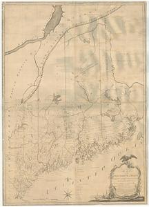
An accurate map of His Majesty's province of New Hampshire in New England, taken from actual surveys of all the inhabited part,...
3.
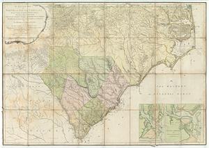
An accurate map of North and South Carolina with their Indian frontiers : shewing in a distinct manner all the mountains,...
4.
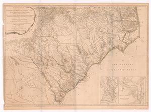
An accurate map of North and South Carolina with their Indian frontiers, shewing in a distinct manner all the mountains,...
5.
An accurate map of the commonwealth of Massachusetts exclusive of the district of Maine compiled pursuant to an act of the...
6.
An accurate map, of the district of Maine being part of the commonwealth of Massachusetts : compiled pursuant to an act of the...
7.
America
8.
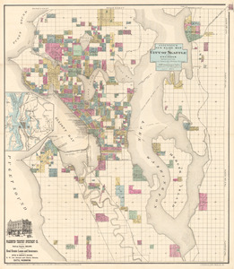
Anderson’s new guide map of the city of Seattle and environs
9.
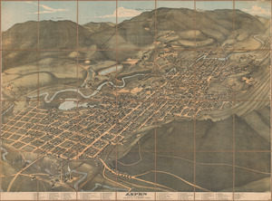
Bird’s eye view of Aspen, Pitkin Co. Colo. 1893
10.
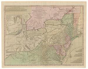
Bowles's new pocket map of the following independent states of North America, viz. Virginia, Maryland, Delaware, Pensylvania,...
11.
British dominions in America agreeable to the treaty of 1763 : divided into the several provinces, and jurisdictions
12.
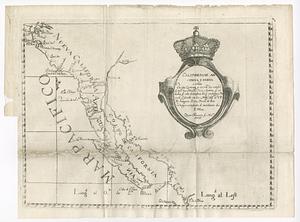
Californias: Antigua y nueva
13.
Canada Louisiane et terres angloises
14.
Canada Louisiane et terres angloises
15.
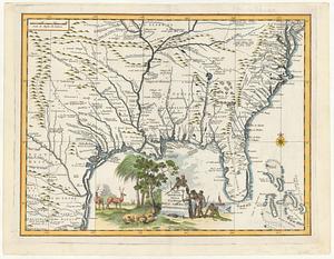
Carta geografica della Florida nell' America settentrional
16.
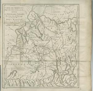
Carte de Kentucke, d'apres les observations actuelles : dediee a l'honorable Congres des Etats-Unis de l'Amerique et a son...
17.
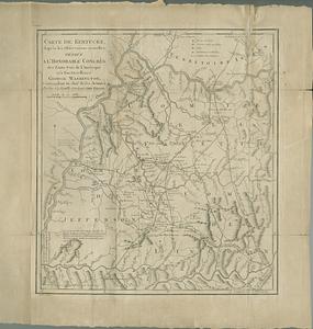
Carte de Kentucke, d'apres les observations actuelles : dediee a l'honorable congres des Etats-Unis de l'Amerique et a son...
18.
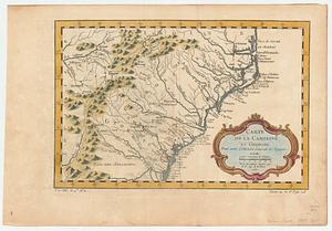
Carte de la Caroline et Georgie : pour servir à l'histoire générale des voyages
19.
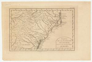
Carte de la Caroline et Georgie : pour servir à l'histoire générale des voyages
20.
Carte de la Louisiane
‹ Prev
Next ›
1
2
3
4
5
…
10
11