Toggle navigation
LMEC Home
Exhibitions
Georeferencing
Tools for Teachers
Collections
My Favorites
Sign Up / Log In
Search
Search the map portal
Map Collection
Map Collection
Map Sets
Search
Search
Search for
Search In
All Fields
Creator
Title
Subject
Place
Search All Digital Collections
Advanced Search
20 Results
My Search
Start Over
More Like
commonwealth:w3768q27s
Remove constraint More Like: commonwealth:w3768q27s
Topic
United States--Maps
Remove constraint Topic: United States--Maps
Filter your Search
Place
United States
20
North and Central America
18
North America
11
Canada
2
Mexico
2
Alaska
1
Caribbean Sea
1
Mesoamerica
1
more
Place
»
Topic
United States--Maps
[remove]
20
North America--Maps
11
Canada--Maps
2
Mexico--Maps
2
West Indies--Maps
2
Alaska--Maps
1
Atlantic Coast (North America)--Maps
1
Caribbean Area--Maps
1
more
Topic
»
Date
Date range begin
–
Date range end
Current results range from
1758
to
1897
1758 : 1898
1758
1898
View distribution
Creator
Bradley, Abraham, 1767-1838
2
Carey, Mathew, 1760-1839
2
Carleton, Osgood, 1742-1816
2
Colton, J. H. (Joseph Hutchins), 1800-1893
2
Lewis, Samuel, 1753 or 1754-1822
2
Bonne, Rigobert, 1727-1794
1
Bure
1
Clúny, Alexander
1
more
Creator
»
Format
Maps/Atlases
20
Georeferenced
Yes
5
No
15
Collection
Norman B. Leventhal Map & Education Center Collection
10
MacLean Collection Map Library
9
American Revolutionary War-Era Maps
8
William L. Clements Library Collection
1
Available to use
No known restrictions
10
Search Constraints
Sort by relevance
relevance
title
date (asc)
date (desc)
Number of results to display per page
20 per page
10
per page
20
per page
50
per page
100
per page
View results as:
grid view
map view
Search Results
1.
Colton's map of the United States of America, the British provinces, Mexico and the West Indies : showing the country from the...
2.
Diagram of the United States of America, Mexico, the West India Islands and Isthmus of Darien : showing proposed routes of the...
3.
Karte von Nord-America für den schul- und privatgebrauch
4.
A Map exhibiting the frontiers of Canada and the United States : intended to illustrate the operations of the British &...
5.
Map of North America : showing all routes to Alaska and Klondike country
6.
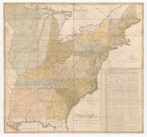
Map of the United States : intending chiefly to exhibit the post roads & distances
7.
Map of the United States of America, the British Provinces, Mexico, the West Indies and Central America, with part of New...
8.
Map of the United States of North America
9.
Map of the United States, the British provinces, Mexico, &c : showing the routes of the U.S. Mail steam packets to California,...
10.
Staaten am Atlantischen Ocean
11.
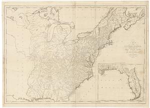
The United States according to the definitive treaty of peace signed at Paris, Septr. 3d. 1783 ...
12.
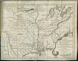
Carte de la Louisiane colonie francaise avec le cours du fleuve St. Louis, les rivieres adjacentes, les nations des naturels,...
13.
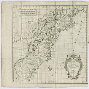
Carte generale des treize Etats-Unis & independants de l'Amerique Septentrional
14.
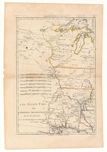
Les Etats Unis de l'Amérique Septentrional partie occidentale ; les Etats Unis de l'Amérique Septentrional partie orientale
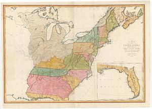
15.
A map of the United States: compiled chiefly from the state maps, and other authentic information
16.
A map of the United States: compiled chiefly from the state maps, and other authentic information
17.
Map of the United States, exhibiting the post-roads, the situations, connections & distances of the post-offices stage roads,...
18.
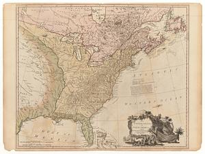
A new map of the United States of America : drawn from the latest authorities
19.
A new map of the United States of America including part of Louisiana : part of Canada & of East Florida and the whole of West...
20.
The United States of North America : with the British & Spanish territories according to the treaty, of 1784