Toggle navigation
LMEC Home
Exhibitions
Georeferencing
Tools for Teachers
Collections
My Favorites
Sign Up / Log In
Search
Search the map portal
Map Collection
Map Collection
Map Sets
Search
Search
Search for
Search In
All Fields
Creator
Title
Subject
Place
Search All Digital Collections
Advanced Search
8552 Results
My Search
Start Over
More Like
commonwealth:4m90f2085
Remove constraint More Like: commonwealth:4m90f2085
Available to use
No known restrictions
Remove constraint Available to use: No known restrictions
Filter your Search
Place
North and Central America
5,810
United States
4,729
Massachusetts
2,041
Europe
1,394
Suffolk (county)
1,019
Boston
993
Canada
449
Asia
425
more
Place
»
Topic
Boston (Mass.)--Maps
574
United States--Maps
209
Real property--Massachusetts--Boston--Maps
173
Massachusetts--Maps
154
Landowners--Massachusetts--Boston--Maps
132
North America--Maps--Early works to 1800
103
New England--Maps
102
Europe--Maps
79
more
Topic
»
Date
Date range begin
–
Date range end
Current results range from
1482
to
2022
1482 : 2023
1482
2023
View distribution
Creator
United States. Hydrographic Office
595
O.H. Bailey & Co
148
Des Barres, Joseph F. W. (Joseph Frederick Wallet), 1722-1824
123
United States. Post Office Dept
120
Ptolemy, 2nd cent
100
Walling, Henry Francis, 1825-1888
94
Geological Survey (U.S.)
86
Jefferys, Thomas, -1771
84
more
Creator
»
Format
Maps/Atlases
8,492
Manuscripts
215
Prints
56
Books
35
Objects/Artifacts
10
Drawings/Illustrations
8
Posters
5
Georeferenced
Yes
836
No
7,716
Collection
Norman B. Leventhal Map & Education Center Collection
8,552
Boston and New England Maps
2,197
Urban Maps
2,008
Maritime Charts and Atlases
1,082
American Revolutionary War-Era Maps
614
Boston Redevelopment Authority Collection
87
Available to use
No known restrictions
[remove]
8,552
Search Constraints
Sort by relevance
relevance
title
date (asc)
date (desc)
Number of results to display per page
20 per page
10
per page
20
per page
50
per page
100
per page
View results as:
grid view
map view
Search Results
1.
Center of New York, first city of the world
2.
Hagstrom's map of Brooklyn (New York City) : house-number and subway guide
3.
Hammond's complete map of New York City
4.
Map of New York City showing concrete socialism in red, and private enterprises in white, 1895
5.
Map of northern part of New York City
6.
Map of the city & county of New York
7.
Map of the part of the boroughs of Manhattan and Bronx, New York City
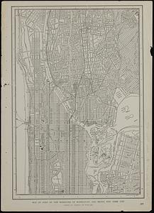
8.
New map of New York City : from the latest authentic surveys, showing all ferries, and all steamship docks both foreign and...
9.
New York City : (southern part)
10.
A pictorial map of that portion of New York City known as Manhattan, also showing parts of the Bronx
11.
The 100th anniversary map of Abraham Lincoln's visit to Massachusetts, September 11-23, 1848
12.
1630 shoreline
13.
1879. Progress map of the U.S. Geographical Surveys west of the 100th Meridian : prepared under the direction of 1st Lieut....
14.
1903 Map of Salem and surrounding places
15.
19th annual convention of the National Association of Real Estate Boards : at Tulsa, June 7 to June 11 in 1926
16.
2005 significant U.S. hurricane strikes
17.
227 Harzgerode
18.
305 Glatz
19.
38,000,000 escaped -- 10,000,000 died
20.
4 Kinten
+
-
Redo search here
Search when I move the map
Leaflet
| ©
OpenStreetMap
contributors, ©
CartoDB
‹ Prev
Next ›
1
2
3
4
5
…
427
428