Toggle navigation
LMEC Home
Exhibitions
Georeferencing
Tools for Teachers
Collections
My Favorites
Sign Up / Log In
Search
Search the map portal
Map Collection
Map Collection
Map Sets
Search
Search
Search for
Search In
All Fields
Creator
Title
Subject
Place
Search All Digital Collections
Advanced Search
13518 Results
Filter your Search
Place
North and Central America
10,232
United States
8,367
Massachusetts
2,778
Suffolk (county)
1,675
Boston
1,631
Europe
1,386
Canada
949
New York
640
more
Place
»
Topic
Boston (Mass.)--Maps
746
City planning--Massachusetts--Boston--Maps
418
United States--History--Revolution, 1775-1783--Maps
329
United States--Maps
321
Real property--Massachusetts--Boston--Maps
254
Urban renewal--Massachusetts--Boston--Maps
254
Massachusetts--Maps
230
Insurance surveys
197
more
Topic
»
Date
Date range begin
–
Date range end
Current results range from
1482
to
2023
View distribution
Creator
United States. Hydrographic Office
596
Boston Redevelopment Authority
404
Des Barres, Joseph F. W. (Joseph Frederick Wallet), 1722-1824
247
Royal United Services Institute for Defence and Security Studies
160
Jefferys, Thomas, -1771
154
George, III, King of Great Britain, 1738-1820
152
George, IV, King of Great Britain, 1762-1830
151
O.H. Bailey & Co
148
more
Creator
»
Format
Maps/Atlases
13,337
Manuscripts
985
Prints
102
Books
49
Drawings/Illustrations
44
Photographs
15
Objects/Artifacts
13
Documents
7
more
Format
»
Georeferenced
Yes
979
No
12,539
Collection
Norman B. Leventhal Map & Education Center Collection
9,022
American Revolutionary War-Era Maps
3,305
Boston and New England Maps
2,900
Urban Maps
2,425
Maritime Charts and Atlases
1,167
William L. Clements Library Collection
910
Library of Congress Collection
618
Boston Redevelopment Authority Collection
475
more
Collection
»
Available to use
No known restrictions
10,085
Creative Commons license
1,677
Search Constraints
Sort by relevance
relevance
title
date (asc)
date (desc)
Number of results to display per page
20 per page
10
per page
20
per page
50
per page
100
per page
View results as:
grid view
map view
Search Results
961.
Bay of Massefao, island of Tutuila ; Bay of Fagaitui, island of Tutuila ; Sketch of Aluau Bay, 1839 ; Sketch of Anuu Island, 1839
962.
Bay of Massefao, island of Tutuila ; Bay of Fagaitui, island of Tutuila ; Sketch of Aluau Bay, 1839 ; Tutuila Isld., approaches...
963.
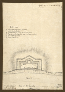
Bay of Pensacola, fortification
964.
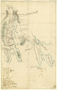
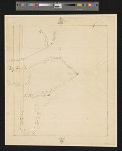
[Bay of Seven Islands]
965.
Bay State Street Ry. Co's lines and connections
966.
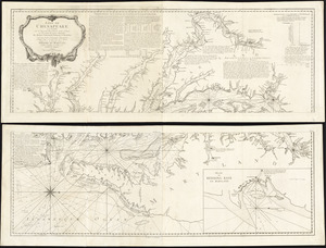
Baye de Chesapeake en 4 feuilles avec les bas fonds, passes, entrées, sondes et routes ou l'on donne les parties navigables...
967.
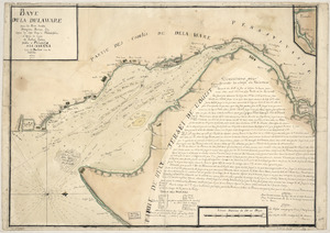
Baye de la Delaware avec les ports, sondes, dangers, bancs, &c. depuis les caps jusqu'a Philadelphie : d'après la carte de...
968.
Baye et port de Boston
969.
Baye et port de Boston
970.
Baye et port d'Yorc capitale de la Nouvelle Yorc
971.
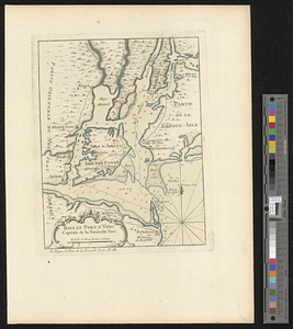
Baye et port d'Yorc, capitale de la Nouvelle Yorc
972.
The Bear Garden, the Globe Theatre
973.
La Beauce
974.
Beaufort Harbor and coast line between Charleston S.C. and Savanna Ga : with 5 mile distance lines in circles round Beaufort...
975.
Becket
976.
Becket, Mass
977.
Beddington, Surrey : plan of Croydon sewage farm
978.
Bedford
979.
Bedford &c.
980.
Bedford Co., Pa
‹ Prev
Next ›
1
2
…
45
46
47
48
49
50
51
52
53
…
675
676


![[Bay of Seven Islands]](https://bpldcassets.blob.core.windows.net/derivatives/images/commonwealth:7h149v48t/image_thumbnail_300.jpg)