Toggle navigation
LMEC Home
Exhibitions
Georeferencing
Tools for Teachers
Collections
My Favorites
Sign Up / Log In
Search
Search the map portal
Map Collection
Map Collection
Map Sets
Search
Search
Search for
Search In
All Fields
Creator
Title
Subject
Place
Search All Digital Collections
Advanced Search
2843 Results
My Search
Start Over
atlas
Remove constraint atlas
Filter your Search
Place
North and Central America
1,647
United States
987
Europe
464
Massachusetts
348
Canada
271
Asia
190
South America
189
Suffolk (county)
163
more
Place
»
Topic
Landowners--Massachusetts--Boston--Maps
115
Real property--Massachusetts--Boston--Maps
106
United States--Maps
87
Boston (Mass.)--Maps
63
United States--History--French and Indian War, 1754-1763--Maps
63
Saint Lawrence River--Maps
41
Nautical charts--Early works to 1800
39
North America--Maps--Early works to 1800
36
more
Topic
»
Date
Date range begin
–
Date range end
Current results range from
1482
to
2023
View distribution
Creator
United States. Hydrographic Office
582
Des Barres, Joseph F. W. (Joseph Frederick Wallet), 1722-1824
118
Ptolemy, 2nd cent
100
Bromley, George Washington
99
Bromley, Walter Scott
97
G.W. Bromley & Co.
75
Carey, Mathew, 1760-1839
74
Paullin, Charles Oscar, 1868 or 1869-1944
70
more
Creator
»
Format
Maps/Atlases
2,827
Manuscripts
58
Books
37
Prints
8
Documents
5
Drawings/Illustrations
1
Georeferenced
Yes
142
No
2,701
Collection
Norman B. Leventhal Map & Education Center Collection
2,386
Maritime Charts and Atlases
1,150
American Revolutionary War-Era Maps
504
Boston and New England Maps
374
Urban Maps
250
Massachusetts Real Estate Atlases
144
William L. Clements Library Collection
92
Mapping Boston Collection
61
more
Collection
»
Available to use
No known restrictions
2,292
Creative Commons license
158
Search Constraints
Sort by relevance
relevance
title
date (asc)
date (desc)
Number of results to display per page
20 per page
10
per page
20
per page
50
per page
100
per page
View results as:
grid view
map view
Search Results
1121.
China
1122.
China : sheet IV south coast from Chauan Bay to Port Matheson including the Pescadore Islands
1123.
China : sheet V eastern coast from Port Matheson to Ragged Point
1124.
China : sheet VIII eastern coast Hieshan Isles to the Yang-Tse-Kiang including the Chusan Islands
1125.
China, east coast, the River Min from the entrance to the Pagoda Anchorage
1126.
China, Korean Archipelago, Nan How Group, Port Hamilton : from the most recent British survey
1127.
China, north east coast, Shantung Promontory, Kyau-Chau Bay to Miau-Tau Strait : from Brit. surveys in 1857-66, corrected to...
1128.
China Sea
1129.
China Sea, channel between Lamtia Island and House Hill
1130.
China Sea, Gaspar Strait with its three channels
1131.
China Sea, Hongkong, Man of War Anchorage : from a British survey in 1877
1132.
Coast of North America from Point Judith to St. Antonio, (island of Cuba) including the Bahama Banks
1133.
Coast of Nova Scotia from Barrington Bay to Cape Blancherolte
1134.
Coast of Nova Scotia from Barrington Bay to Cape Blancherolte
1135.
The coasts of the Hwang Hai or Yellow Sea and Gulf of Pechili : compiled from the latest information
1136.
Cuba, south coast, approaches to Ports Casilda and Masio with the adjacent anchorages : from a Spanish government chart of 1879
1137.
Deans, Krusensterns, and Lazareff Islands
1138.
Deans, Krusensterns, and Lazareff Islands
1139.
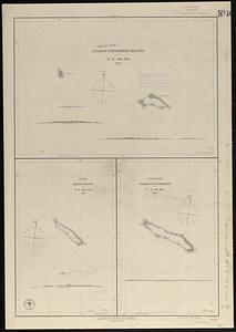
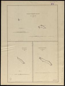
Disappointment Group ; Reao or Serle Island ; Pukaruha or Clermont-Tonnere
1140.
Disappointment Group ; Serle Island ; Clermont-Tonnere
‹ Prev
Next ›
1
2
…
53
54
55
56
57
58
59
60
61
…
142
143