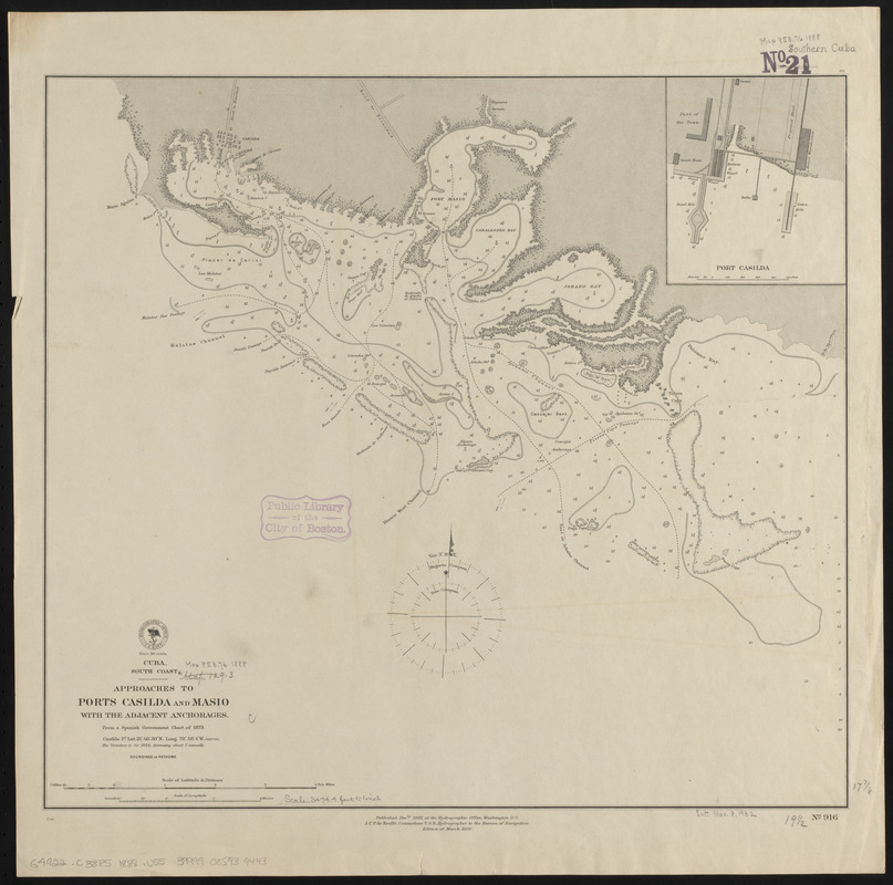
Cuba, south coast, approaches to Ports Casilda and Masio with the adjacent anchorages : from a Spanish government chart of 1879
Item Information
- Title:
- Cuba, south coast, approaches to Ports Casilda and Masio with the adjacent anchorages : from a Spanish government chart of 1879
- Title (alt.):
-
Approaches to Ports Casilda and Masio with the adjacent anchorages
- Issuing body:
- United States. Hydrographic Office
- Date:
-
1888
- Format:
-
Maps/Atlases
- Location:
-
Boston Public Library
Norman B. Leventhal Map & Education Center - Collection (local):
-
Norman B. Leventhal Map & Education Center Collection
- Subjects:
-
Nautical charts--Cuba--Casilda Bay
Nautical charts--Cuba--Masío Bay
Casilda Bay (Cuba)--Maps
Masío Bay (Cuba)--Maps
- Places:
-
CubaSancti-Spíritus (province)Casilda
Ensenada El Masío
- Extent:
- 1 map ; 46 x 50 cm
- Terms of Use:
-
No known copyright restrictions.
No known restrictions on use.
- Publisher:
-
Washington, D.C. :
Hydrographic Office
- Edition:
- Edition of March 1888
- Scale:
-
Scale approximately 1:59,000
- Language:
-
English
- Notes:
-
Depths shown by soundings and isolines.
Inset: Port Casilda.
- Identifier:
-
06_01_015672
- Call #:
-
G9096.P5 svar .U55
- Barcode:
-
39999085939443


