Toggle navigation
LMEC Home
Exhibitions
Georeferencing
Tools for Teachers
Collections
My Favorites
Sign Up / Log In
Search
Search the map portal
Map Collection
Map Collection
Map Sets
Search
Search
Search for
Search In
All Fields
Creator
Title
Subject
Place
Search All Digital Collections
Advanced Search
13664 Results
Filter your Search
Place
North and Central America
10,330
United States
8,461
Massachusetts
2,784
Suffolk (county)
1,677
Boston
1,633
Europe
1,413
Canada
950
New York
649
more
Place
»
Topic
Boston (Mass.)--Maps
747
City planning--Massachusetts--Boston--Maps
418
United States--History--Revolution, 1775-1783--Maps
329
United States--Maps
321
Real property--Massachusetts--Boston--Maps
254
Urban renewal--Massachusetts--Boston--Maps
254
Massachusetts--Maps
231
Insurance surveys
197
more
Topic
»
Date
Date range begin
–
Date range end
Current results range from
1482
to
2023
View distribution
Creator
United States. Hydrographic Office
597
Boston Redevelopment Authority
404
Des Barres, Joseph F. W. (Joseph Frederick Wallet), 1722-1824
247
Royal United Services Institute for Defence and Security Studies
160
Jefferys, Thomas, -1771
154
George, III, King of Great Britain, 1738-1820
152
George, IV, King of Great Britain, 1762-1830
151
O.H. Bailey & Co
148
more
Creator
»
Format
Maps/Atlases
13,483
Manuscripts
985
Prints
102
Books
49
Drawings/Illustrations
44
Photographs
15
Objects/Artifacts
13
Documents
7
more
Format
»
Georeferenced
Yes
979
No
12,685
Collection
Norman B. Leventhal Map & Education Center Collection
9,088
American Revolutionary War-Era Maps
3,305
Boston and New England Maps
2,909
Urban Maps
2,465
Maritime Charts and Atlases
1,169
William L. Clements Library Collection
910
Library of Congress Collection
618
Boston Redevelopment Authority Collection
475
more
Collection
»
Available to use
No known restrictions
10,231
Creative Commons license
1,677
Search Constraints
Sort by relevance
relevance
title
date (asc)
date (desc)
Number of results to display per page
20 per page
10
per page
20
per page
50
per page
100
per page
View results as:
grid view
map view
Search Results
5121.
[Map of eastern Massachusetts and vicinity]
5122.
Map of eastern Virginia
5123.
Map of eastern Virginia
5124.
[Map of Ecuador]
5125.
Map of Egypt
5126.
Map of Erie County, New York
5127.
Map of Essex County
5128.
Map of Europe : drawn from all the best surveys and rectified by astronomical observations
5129.
Map of Europe : compiled from the latest authorities
5130.
The map of Europe
5131.
A map of Europe, and the countries bordering on the Mediterranean & Black Seas, from the latest authorities
5132.
Map of Europe showing countries as established by the Peace Conference at Paris
5133.
Map of Everett and vicinity
5134.
Map of existing and proposed open spaces in Massachusetts
5135.
Map of explorations and surveys in New Mexico and Utah made under the direction of the Secretary of War by Capt. J. N. Macomb...
5136.
Map of explorations in north western Alaska : under the direction of W.B. Hazen
5137.
Map of farms and lots embraced within the limits of Fairmount Park as appropriated for public use by Act of Assembly, approved...
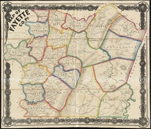
5138.
Map of Fayette Co. Pa
5139.
A map of Fitchburg, Mass
5140.
[Map of Florida, Carolina, and the Gulf Coast]
‹ Prev
Next ›
1
2
…
253
254
255
256
257
258
259
260
261
…
683
684