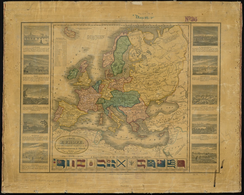
A map of Europe, and the countries bordering on the Mediterranean & Black Seas, from the latest authorities
Item Information
- Title:
- A map of Europe, and the countries bordering on the Mediterranean & Black Seas, from the latest authorities
- Creator:
- Barber, John Warner, 1798-1885
- Date:
-
1831
- Format:
-
Maps/Atlases
- Location:
-
Boston Public Library
Norman B. Leventhal Map & Education Center - Collection (local):
-
Norman B. Leventhal Map & Education Center Collection
- Subjects:
-
Europe--Maps
- Places:
-
Europe
Europe
- Extent:
- 1 map : hand colored ; 38 x 37 cm
- Terms of Use:
-
No known copyright restrictions.
No known restrictions on use.
- Publisher:
-
Middletown, Con. :
Edwin Hunt,
- Scale:
-
Scale approximately 1:13,500,000
- Language:
-
English
- Notes:
-
Relief shown by hachures.
Includes population table and illustrations of maritime flags.
Includes views of 10 cities with descriptive text to left and right of the map.
"Entered according to Act of Congress, the 8th day of Oct. 1830 by John W. Barber, of the state of Connecticut."
- Identifier:
-
06_01_012016
- Call #:
-
G5700 1831 .B37
- Barcode:
-
39999065692988


