Toggle navigation
LMEC Home
Exhibitions
Georeferencing
Tools for Teachers
Collections
My Favorites
Sign Up / Log In
Search
Search the map portal
Map Collection
Map Collection
Map Sets
Search
Search
Search for
Search In
All Fields
Creator
Title
Subject
Place
Search All Digital Collections
Advanced Search
10713 Results
My Search
Start Over
All Fields
americas
Remove constraint All Fields: americas
Filter your Search
Place
North and Central America
10,111
United States
8,243
Massachusetts
2,691
Suffolk (county)
1,662
Boston
1,619
Canada
936
New York
640
Middlesex (county)
424
more
Place
»
Topic
Boston (Mass.)--Maps
740
City planning--Massachusetts--Boston--Maps
418
United States--History--Revolution, 1775-1783--Maps
327
United States--Maps
313
Urban renewal--Massachusetts--Boston--Maps
254
Real property--Massachusetts--Boston--Maps
252
Massachusetts--Maps
219
Insurance surveys
194
more
Topic
»
Date
Date range begin
–
Date range end
Current results range from
1507
to
2023
View distribution
Creator
Boston Redevelopment Authority
403
United States. Hydrographic Office
365
Des Barres, Joseph F. W. (Joseph Frederick Wallet), 1722-1824
197
Jefferys, Thomas, -1771
150
George, III, King of Great Britain, 1738-1820
146
O.H. Bailey & Co
146
George, IV, King of Great Britain, 1762-1830
145
Royal United Services Institute for Defence and Security Studies
139
more
Creator
»
Format
Maps/Atlases
10,590
Manuscripts
916
Prints
60
Books
43
Drawings/Illustrations
43
Photographs
15
Objects/Artifacts
7
Posters
3
more
Format
»
Georeferenced
Yes
823
No
9,890
Collection
Norman B. Leventhal Map & Education Center Collection
6,479
American Revolutionary War-Era Maps
3,123
Boston and New England Maps
2,801
Urban Maps
2,249
William L. Clements Library Collection
892
Maritime Charts and Atlases
802
Library of Congress Collection
552
Boston Redevelopment Authority Collection
475
more
Collection
»
Available to use
No known restrictions
7,530
Creative Commons license
1,540
Search Constraints
Sort by relevance
relevance
title
date (asc)
date (desc)
Number of results to display per page
20 per page
10
per page
20
per page
50
per page
100
per page
View results as:
grid view
map view
Search Results
1681.
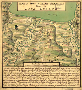
Plan of Fort William Henry and camp at Lake George
1682.
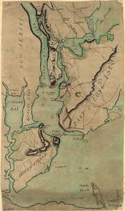
Plan of New York and Staten Islands with part of Long Island
1683.
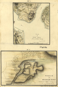
Plan of Perth Amboy from an actual survey. Sketch of Bonham Town
1684.
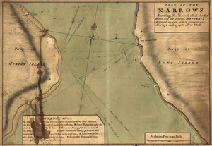
Plan of The Narrows, shewing the channel, shoal, depth of water, and the several battery's proposed on each side to prevent an...
1685.
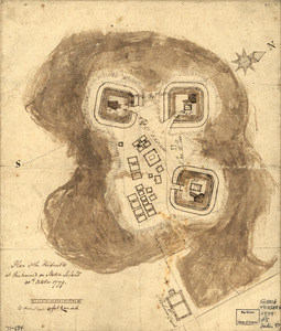
Plan of the redoubts at Richmond on Staten Island, 30th October 1779
1686.
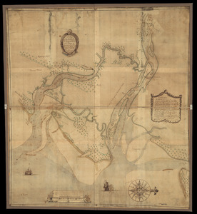
A plan of the town, bar, harbour, and environs of Charlestown in South Carolina : with all the channels, soundings,...
1687.
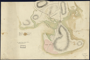
Sketch of the ground about Charles Town
1688.
Sketch of the harbour of Charles Town
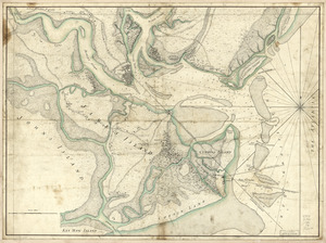
1689.
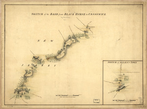
Sketch of the road from Black Horse to Crosswick
1690.
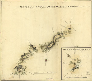
Sketch of the road from Black Horse to Crosswick. Sketch of Allen's Town
1691.
Soundings of the bar of Sandy Hook at low water & the marks made use of for the best water
1692.
St. Augustine and its environs
1693.
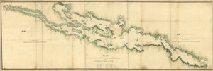
A survey of Frog's Neck and the rout[e] of the British Army : to the 24th of October 1776, under the command of His Excellency...
1694.
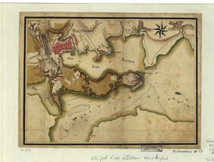
Ville, port, et rade de Baltimore dans le Maryland
1695.
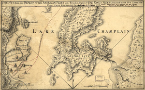
The Attack and defeat of the American fleet under Benedict Arnold : by the King's fleet commanded by Sir Guy Carleton upon Lake...
1696.
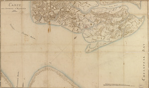
Carte des environs d'Hampton
1697.
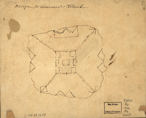
Design for Governor's Island
1698.
Plan, Lake Champlain from Fort St. John's to Ticonderoga : with the soundings, rocks, shoals, and sands, surveyed in the years...
1699.
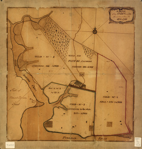
A plan of my farm on Little Huntg. Creek & Potomk. R
1700.
A plan of the inlets & rivers of Savannah & Warsaw in the Province of Georgia
‹ Prev
Next ›
1
2
…
81
82
83
84
85
86
87
88
89
…
535
536

![A survey of Frog's Neck and the rout[e] of the British Army](https://bpldcassets.blob.core.windows.net/derivatives/images/commonwealth:q524n8606/image_thumbnail_300.jpg)