Toggle navigation
LMEC Home
Exhibitions
Georeferencing
Tools for Teachers
Collections
My Favorites
Sign Up / Log In
Search
Search the map portal
Map Collection
Map Collection
Map Sets
Search
Search
Search for
Search In
All Fields
Creator
Title
Subject
Place
Search All Digital Collections
Advanced Search
10713 Results
My Search
Start Over
All Fields
americas
Remove constraint All Fields: americas
Filter your Search
Place
North and Central America
10,111
United States
8,243
Massachusetts
2,691
Suffolk (county)
1,662
Boston
1,619
Canada
936
New York
640
Middlesex (county)
424
more
Place
»
Topic
Boston (Mass.)--Maps
740
City planning--Massachusetts--Boston--Maps
418
United States--History--Revolution, 1775-1783--Maps
327
United States--Maps
313
Urban renewal--Massachusetts--Boston--Maps
254
Real property--Massachusetts--Boston--Maps
252
Massachusetts--Maps
219
Insurance surveys
194
more
Topic
»
Date
Date range begin
–
Date range end
Current results range from
1507
to
2023
View distribution
Creator
Boston Redevelopment Authority
403
United States. Hydrographic Office
365
Des Barres, Joseph F. W. (Joseph Frederick Wallet), 1722-1824
197
Jefferys, Thomas, -1771
150
George, III, King of Great Britain, 1738-1820
146
O.H. Bailey & Co
146
George, IV, King of Great Britain, 1762-1830
145
Royal United Services Institute for Defence and Security Studies
139
more
Creator
»
Format
Maps/Atlases
10,590
Manuscripts
916
Prints
60
Books
43
Drawings/Illustrations
43
Photographs
15
Objects/Artifacts
7
Posters
3
more
Format
»
Georeferenced
Yes
823
No
9,890
Collection
Norman B. Leventhal Map & Education Center Collection
6,479
American Revolutionary War-Era Maps
3,123
Boston and New England Maps
2,801
Urban Maps
2,249
William L. Clements Library Collection
892
Maritime Charts and Atlases
802
Library of Congress Collection
552
Boston Redevelopment Authority Collection
475
more
Collection
»
Available to use
No known restrictions
7,530
Creative Commons license
1,540
Search Constraints
Sort by relevance
relevance
title
date (asc)
date (desc)
Number of results to display per page
20 per page
10
per page
20
per page
50
per page
100
per page
View results as:
grid view
map view
Search Results
10681.
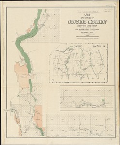
Map of portion of Osoyoos District : British Columbia
10682.
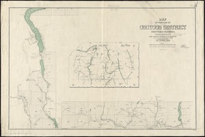
Map of portion of Osoyoos District, British Columbia
10683.
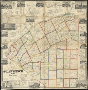
Map of St. Lawrence Co. New York
10684.
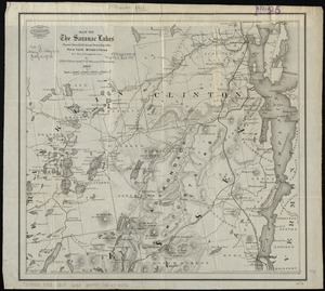
Map of the Saranac Lakes : prepared from Dr. Ely's large pocket map of the New York wilderness for D.L. Fouquet & Son
10685.
North Pacific Islands
10686.
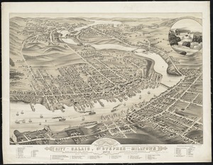
Panoramic view of the city of Calais, St. Stephen and Milltown : Washington Co. Maine, Charlotte Co. New Brunswick : mills,...
10687.
Sketch of Pensacola Navy Yard and Fort Pickens from U.S. coast surveys
10688.
Sketch of the country from Fort Du Quesne to Niagara as described by an intelligent Indian who had resided there for a...
10689.
West Indies, harbors of Jamaica : from British surveys to 1879, corrected to 1881
10690.
West Indies, ports on the north and west coasts of Haiti : from the most recent surveys
10691.
West-Indies, n. coast of Haiti, from Monte Christi to Fort Dauphin Bay ; Fort Dauphin Bay : from a French Survey
10692.
West-Indies, special plans to charts no. 26b & c, Bahama Bank : from British surveys, corrected to 1872
10693.
The country round Washington : the Chesapeake and the Potomac
10694.
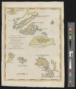
The Dutch islands of St. Eustatia, Saba, and St. Martins; the French island of St. Bartholomew; the English islands of St....
10695.
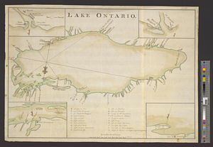
Lake Ontario
10696.
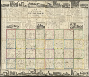
Map of the counties of Eaton and Barry, Michigan
10697.
Plan des environs de West Point jusqu'au Croton River... : Morrishous ce 14me Juin 1779
10698.
Plan of Niagara River between the Lakes Ontario and Erie
10699.
Caribbean Sea--coast of Yucatan, special plans to chart no. 401 : from British surveys, corrected to 1872
10700.
Plans des isles, rades, et ports de plusieurs lieux de l'Amérique : tirés de la Carte angloise de Mr. Popple publiée en 1733...
‹ Prev
Next ›
1
2
…
531
532
533
534
535
536