Toggle navigation
LMEC Home
Exhibitions
Georeferencing
Tools for Teachers
Collections
My Favorites
Sign Up / Log In
Search
Search the map portal
Map Collection
Map Collection
Map Sets
Search
Search
Search for
Search In
All Fields
Creator
Title
Subject
Place
Search All Digital Collections
Advanced Search
10961 Results
My Search
Start Over
All Fields
americas
Remove constraint All Fields: americas
Filter your Search
Place
North and Central America
10,354
United States
8,478
Massachusetts
2,796
Suffolk (county)
1,676
Boston
1,632
Canada
937
New York
650
Middlesex (county)
441
more
Place
»
Topic
Boston (Mass.)--Maps
747
City planning--Massachusetts--Boston--Maps
418
United States--History--Revolution, 1775-1783--Maps
327
United States--Maps
320
Real property--Massachusetts--Boston--Maps
254
Urban renewal--Massachusetts--Boston--Maps
254
Massachusetts--Maps
233
Insurance surveys
194
more
Topic
»
Date
Date range begin
–
Date range end
Current results range from
1507
to
2023
View distribution
Creator
Boston Redevelopment Authority
404
United States. Hydrographic Office
366
Des Barres, Joseph F. W. (Joseph Frederick Wallet), 1722-1824
197
Jefferys, Thomas, -1771
150
George, III, King of Great Britain, 1738-1820
146
O.H. Bailey & Co
146
George, IV, King of Great Britain, 1762-1830
145
Royal United Services Institute for Defence and Security Studies
139
more
Creator
»
Format
Maps/Atlases
10,838
Manuscripts
916
Prints
60
Books
43
Drawings/Illustrations
43
Photographs
15
Objects/Artifacts
7
Posters
3
more
Format
»
Georeferenced
Yes
823
No
10,138
Collection
Norman B. Leventhal Map & Education Center Collection
6,635
American Revolutionary War-Era Maps
3,123
Boston and New England Maps
2,918
Urban Maps
2,294
William L. Clements Library Collection
892
Maritime Charts and Atlases
816
Library of Congress Collection
552
Boston Redevelopment Authority Collection
475
more
Collection
»
Available to use
No known restrictions
7,777
Creative Commons license
1,541
Search Constraints
Sort by relevance
relevance
title
date (asc)
date (desc)
Number of results to display per page
20 per page
10
per page
20
per page
50
per page
100
per page
View results as:
grid view
map view
Search Results
10461.
Map of Andersonville, Sumter Co., Georgia
10462.
Map of Arnold Arboretum showing location of the trees and shrubs
10463.
Map of Arnold Arboretum showing location of the trees and shrubs
10464.
Map of Bar Harbor, Maine
10465.
Map of Cape Nome and Golovin [sic] Bay
10466.
Map of Chelsea, Everett, Revere, & Winthrop
10467.
Map of Chippewa County, state of Wisconsin
10468.
Map of Dorchester, Roxbury, and West Roxbury
10469.
[Map of Florida, Carolina, and the Gulf Coast]
10470.
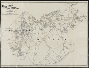
Map of Hyde Park and Milton
10471.
Map of Jeffersonville enlarged
10472.
Map of proposed arboretum, showing its outlines and local connections, with a study for public drive passing through it
10473.
Map of the area between Fort Loudon, Tennessee, and Kaskaskia, Illinois
10474.
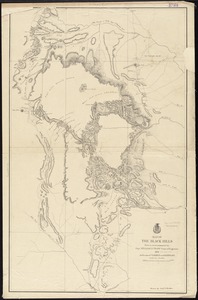
Map of the Black Hills from a reconnaissance by Capt. William Ludlow, Corps of Engineers, 1874, and maps of Warren and Raynolds
10475.
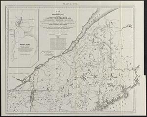
Map of the boundary lines between the United States and the adjacent British provinces from the mouth of the River St. Croix to...
10476.
A map of the most inhabited part of New England : containing the provinces of Massachusets Bay and New Hampshire, with the...
10477.
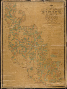
Map of the parishes of Pointe Coupee, West Baton Rouge and Iberville : including parts of the parishes of St. Martins and...
10478.
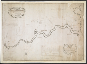
A Map Of the River MERRIMACK from the Atlantick Ocean to Pantuckett Falls describing bounds between His Maj:tys Province of New...
10479.
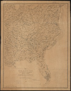
Map of the south Atlantic coast and a portion of the territory tributary thereto : to accompany proceedings of South Atlantic...
10480.
Map of the State of New York with part of the states of Pennsylvania, New Jersey &c
‹ Prev
Next ›
1
2
…
520
521
522
523
524
525
526
527
528
…
548
549


![Map of Cape Nome and Golovin [sic] Bay](https://bpldcassets.blob.core.windows.net/derivatives/images/commonwealth:4m90fc12m/image_thumbnail_300.jpg)


![[Map of Florida, Carolina, and the Gulf Coast]](https://bpldcassets.blob.core.windows.net/derivatives/images/commonwealth:z603vr379/image_thumbnail_300.jpg)