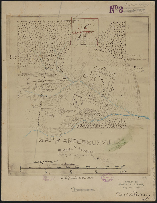
Map of Andersonville, Sumter Co., Georgia
Item Information
- Title:
- Map of Andersonville, Sumter Co., Georgia
- Cartographer:
- Carleton, George W.
- Name on Item:
-
surveyed and drawn by Geo. W. Carleton, asst. engr.
- Date:
-
[1865]
- Format:
-
Maps/Atlases
Manuscripts
- Location:
-
Boston Public Library
Norman B. Leventhal Map & Education Center - Collection (local):
-
Norman B. Leventhal Map & Education Center Collection
- Subjects:
-
Andersonville (Ga.)--Maps
Andersonville National Historic Site (Ga.)--Maps
United States--History--Civil War, 1861-1865--Maps
- Places:
-
GeorgiaSumter (county)Andersonville National Historical Site
GeorgiaSumter (county)Andersonville
- Extent:
- 1 manuscript map : hand-color ; 27 x 24 cm
- Terms of Use:
-
No known copyright restrictions.
No known restrictions on use.
- Place of origin:
-
[Georgia]
- Scale:
-
Scale approximately 1:9,204
- Language:
-
English
- Notes:
-
Manuscript map in ink showing Andersonville and the military prison and graveyard used by the confederates during the American Civil War.
Relief shown by contours.
Carleton sent to Andersonville in May 1865 to produce a topographical survey of the prison and its surroundings, and submitted map and field notes to Major General H. Wilson before his release in June 1865.
- Notes (date):
-
This date is inferred.
- Identifier:
-
06_01_014623
- Call #:
-
G3924.A43 1860 .C37
- Barcode:
-
39999065704692


