Toggle navigation
LMEC Home
Exhibitions
Georeferencing
Tools for Teachers
Collections
My Favorites
Sign Up / Log In
Search
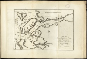
Search the map portal
Map Collection
Map Collection
Map Sets
Search
Search
Search for
Search In
All Fields
Creator
Title
Subject
Place
Search All Digital Collections
Advanced Search
98 Results
My Search
Start Over
g1105
Remove constraint g1105
Filter your Search
Place
North and Central America
68
United States
25
Canada
14
North America
6
Québec
6
Atlantic Ocean
4
French Guiana
4
New England
4
more
Place
»
Topic
North America--Maps--Early works to 1800
6
America--Discovery and Exploration--Maps--Early works to 1800
5
Québec (Québec)--Maps--Early works to 1800
5
Tactics--Maps--Early works to 1800
5
Braddock's Campaign, 1755--Maps
4
New England--Maps--Early works to 1800
4
United States--History--French and Indian War, 1754-1763--Maps
4
United States--History--French and Indian War, 1754-1763--Maps--Early works to 1800
4
more
Topic
»
Date
Date range begin
–
Date range end
Current results range from
1511
to
1777
View distribution
Creator
Jefferys, Thomas, -1771
76
Sayer, Robert, 1725-1794
66
Celi, Francisco Mathias
8
Le Rouge, Georges-Louis.
7
Green, John, -1757
6
Orme, Robert, -1781
6
Bellin, Jacques Nicolas, 1703-1772
2
Bully, le sieur
2
more
Creator
»
Format
Maps/Atlases
98
Georeferenced
Yes
1
No
97
Collection
Norman B. Leventhal Map Center Collection
98
American Revolutionary War-Era Maps
68
Maritime Charts and Atlases
20
Boston and New England Maps
4
Urban Maps
2
Available to use
No known restrictions
98
Search Constraints
Sort by relevance
relevance
title
date (asc)
date (desc)
Number of results to display per page
20 per page
10
per page
20
per page
50
per page
100
per page
View results as:
grid view
map view
Search Results
1.
A map of the discoveries made by the Russians on the North West coast of America
2.
North America : from the French of Mr. d'Anville, improved with the back settlements of Virginia and course of Ohio,...
3.
An accurate map of His Majesty's province of New-Hampshire in New England : taken from actual surveys of all the inhabited...
4.
An accurate map of North America : describing and distinguishing the British, Spanish and French dominions on this great...
5.
Antigoa
6.
An authentic plan of the River St. Laurence from Sillery to the fall of Montmorenci, with the operations of the siege of Quebec...
7.
An authentic plan of the town and harbour of Cap-François in the isle of St. Domingo
8.
The Caribbee Islands and Guayana
9.
Carte des bayes, rades, et port de Plaisance dans l'isle de Terre-Neuve
10.
Carte d'une partie de l'Amérique Septentrionale : pour servir à l'intellegence du mémoire sur les prétentions des Anglois...
11.
Charles-town, capitale de la Caroline
12.
Chart comprizing Greenland with the countries and islands about Baffin's and Hudson's Bays
13.
Chart containing part of the Icy Sea with the adjacent coast of Asia and America
14.
Chart containing the coasts of California, New Albion, and Russian discoveries to the north : with the peninsula of Kamchatka,...
15.
Chart containing the greater part of the South Sea to the south of the line, with islands dispersed thro' the same
16.
Chart of South America, comprehending the West Indies, with the adjacent islands, in the Southern Ocean, and South Sea
17.
Chart of the Atlantic Ocean, with the British, French, & Spanish settlements in North America, and the West Indies : as also on...
18.
Chart of the Atlantic Ocean, with the British, French, & Spanish settlements in North America, and the West Indies : as also on...
19.
A chart of the harbour of Halifax in Nova Scotia : with Jebucto Bay and Cape Sambro also the islands, ledges of rocks, shoals &...
20.
A correct plan of the environs of Quebec, and of the battle fought on the 13th September, 1759 : together with a particular...
‹ Prev
Next ›
1
2
3
4
5