Toggle navigation
LMEC Home
Exhibitions
Georeferencing
Tools for Teachers
Collections
My Favorites
Sign Up / Log In
Search
Search the map portal
Map Collection
Map Collection
Map Sets
Search
Search
Search for
Search In
All Fields
Creator
Title
Subject
Place
Search All Digital Collections
Advanced Search
1494 Results
My Search
Start Over
Subject
"Boston (Mass.)--Maps"
Remove constraint Subject: "Boston (Mass.)--Maps"
Filter your Search
Place
North and Central America
1,493
United States
1,491
Suffolk (county)
1,409
Boston
1,405
Massachusetts
1,116
Boston Harbor
126
Roxbury
91
Charlestown
71
more
Place
»
Topic
Boston (Mass.)--Maps
753
City planning--Massachusetts--Boston--Maps
408
Real property--Massachusetts--Boston--Maps
245
Urban renewal--Massachusetts--Boston--Maps
245
Landowners--Massachusetts--Boston--Maps
161
Buildings--Massachusetts--Boston--Maps
124
Land use--Massachusetts--Boston--Maps
100
Roxbury (Boston, Mass.)--Maps
90
more
Topic
»
Date
Date range begin
–
Date range end
Current results range from
1689
to
2023
View distribution
Creator
Boston Redevelopment Authority
387
Bromley, George Washington
69
Bromley, Walter Scott
68
G.W. Bromley & Co.
46
Geo. H. Walker & Co
28
Boston (Mass.). Engineering Dept
21
Boynton, George W., d. 1884
21
Sampson, Davenport & Co
21
more
Creator
»
Format
Maps/Atlases
1,491
Manuscripts
50
Drawings/Illustrations
5
Posters
1
Prints
1
Georeferenced
Yes
140
No
1,354
Collection
Boston and New England Maps
1,215
Urban Maps
1,019
Norman B. Leventhal Map & Education Center Collection
1,010
Boston Redevelopment Authority Collection
449
American Revolutionary War-Era Maps
132
Mapping Boston Collection
53
Massachusetts Real Estate Atlases
38
Maritime Charts and Atlases
28
more
Collection
»
Available to use
No known restrictions
1,309
Creative Commons license
116
Search Constraints
Sort by relevance
relevance
title
date (asc)
date (desc)
Number of results to display per page
20 per page
10
per page
20
per page
50
per page
100
per page
View results as:
grid view
map view
Search Results
1461.
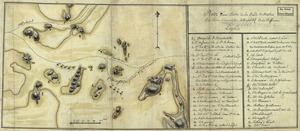
Plan d'une partie de la rade de Boston pour faire connaitre le dispositif de ses deffenses
1462.
A plan of the action at Breeds Hill, on the 17th of June 1775 : between the American forces and the British troops :...
1463.
A plan of the action at Bunkers Hill, on the 17th. of June, 1775 : between His Majesty's troops under the command of Major...
1464.
A plan of the action at Bunkers Hill, on the 17th. of June, 1775 : between His Majesty's troops under the command of Major...
1465.
A plan of the action at Bunkers Hill, on the 17th. of June, 1775 : between His Majesty's troops under the command of Major...
1466.
A plan of the action at Bunkers Hill on the 17th of June 1775 between His Majesty's troops, under the command of Major General...
1467.
A plan of the action at Bunkers Hill on the 17th of June 1775 between His Majesty's troops, under the command of Major General...
1468.
A plan of the action at Bunkers Hill on the 17th of June 1775 between His Majesty's troops, under the command of Major General...
1469.
Plan of the battle, on Bunker's Hill : fought on the 17th of June 1775
1470.
Plan of the battle, on Bunker's Hill : fought on the 17th of June 1775
1471.
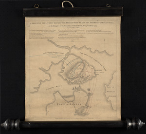
A sketch of the action between the British forces and the American provincials, on the heights of the peninsula of Charlestown,...
1472.
A sketch of the action between the British forces and the American provincials, on the heights of the peninsula of Charlestown,...
1473.
Atlas of the county of Suffolk, Massachusetts : vol. 4th including East Boston, city of Chelsea, Revere and Winthrop : from...
1474.
Fenway urban renewal area, Massachusetts R-115 : illustrative site plan
1475.
A new and accurate chart of the harbour of Boston in New England in North America
1476.
Atlas of Massachusetts
1477.
Boston et ses environs
1478.
Carte du port et havre de Boston avec les côtes adjacentes, dans laquel on a tracée les camps et les retranchemens occupé,...
1479.
Carte du port et havre de Boston avec les côtes adjacentes, dans laquel on a tracée les camps et les retranchemens occupé,...
1480.
Carte du port et havre de Boston avec les côtes adjacentes, dans laquel on a tracée les camps et les retranchemens occupé,...
‹ Prev
Next ›
1
2
…
70
71
72
73
74
75