Boston et ses environs
Item Information
- Title:
- Boston et ses environs
- Description:
-
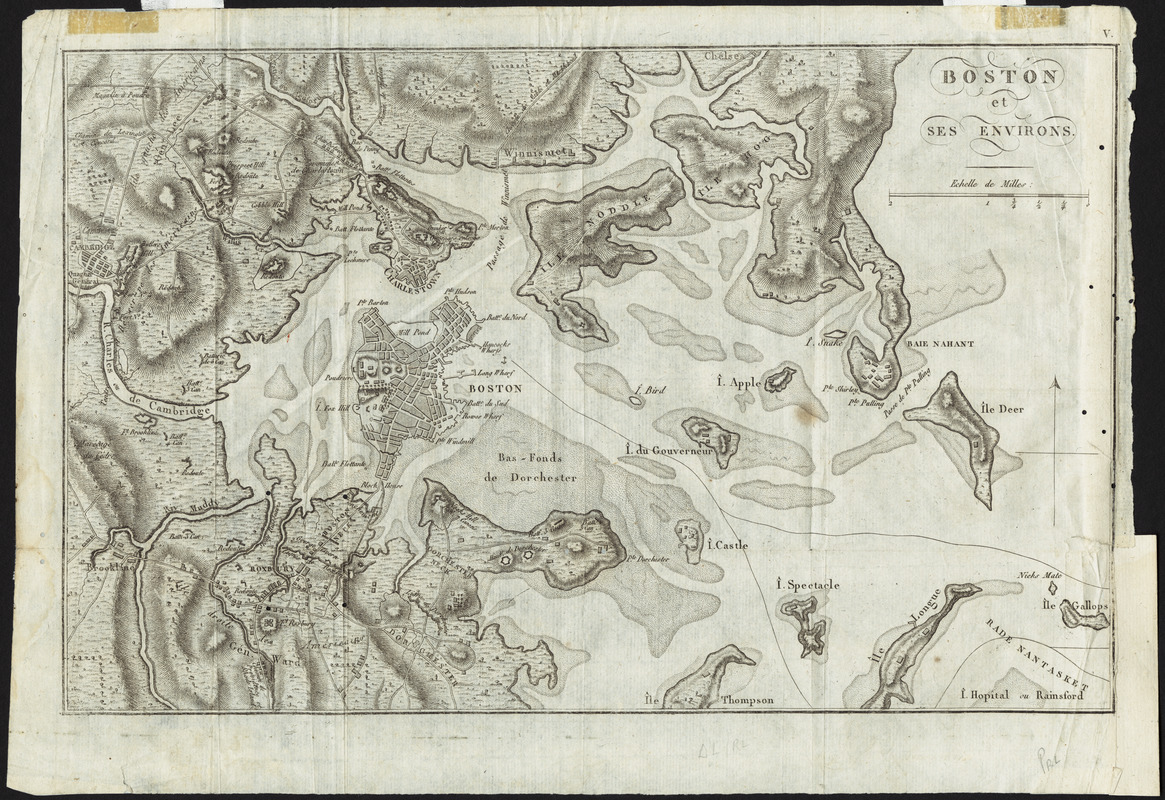
Reflecting French interest in the American Revolutionary War, this French publication was copied from a similar map of Boston and vicinity published in London in 1778. The original map was based on the British intelligence of Lieutenant Page. As a record of the military activities in the area, it showed British and American fortifications and troop positions during the siege of Boston. It also identified the roads to Concord and Lexington, as well as the site of the Battle of Bunker Hill.
- Cartographer:
- Page, Thomas Hyde, Sir, 1746-1821
- Date:
-
1780
- Format:
-
Maps/Atlases
- Location:
- Private Collection
- Collection (local):
-
Mapping Boston Collection
- Subjects:
-
Fortification--Massachusetts--Boston--Maps--Early works to 1800
Boston Harbor (Mass.)--Maps--Early works to 1800
Boston (Mass.)--History--Revolution, 1775-1783--Maps--Early works to 1800
- Places:
-
MassachusettsBoston Harbor
- Extent:
- 1 map ; 21 x 32 cm.
- Terms of Use:
-
No known copyright restrictions.
This work is licensed for use under a Creative Commons Attribution Non-Commercial Share Alike License (CC BY-NC-SA).

- Scale:
-
Scale not given
- Language:
-
French
- Notes:
-
Relief shown by hachures.
- Identifier:
-
06_01_001132
- Barcode:
-
39999052508072


