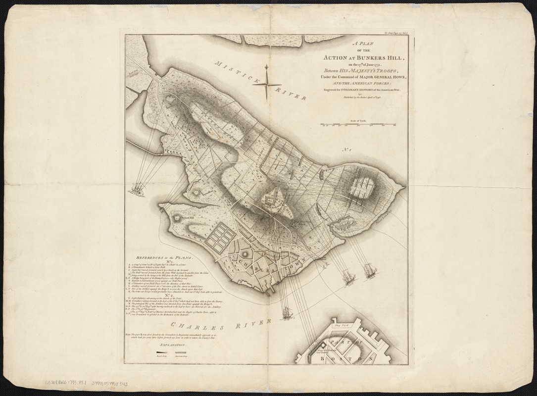
A plan of the action at Bunkers Hill on the 17th of June 1775 between His Majesty's troops, under the command of Major General Howe, and the American forces
This map is also available in American Revolutionary Geographies Online (ARGO), a collections portal especially built for material relating to the American Revolutionary War Era. Visit ARGO to learn more about this item and explore the historical geography of North America in the late eighteenth century.
Item Information
- Title:
- A plan of the action at Bunkers Hill on the 17th of June 1775 between His Majesty's troops, under the command of Major General Howe, and the American forces
- Creator:
- Page, Thomas Hyde, Sir, 1746-1821
- Date:
-
1793
- Format:
-
Maps/Atlases
- Location:
-
Boston Public Library
Norman B. Leventhal Map & Education Center - Collection (local):
-
Norman B. Leventhal Map & Education Center Collection
- Subjects:
-
Bunker Hill, Battle of, Boston, Mass., 1775--Maps--Early works to 1800
Boston (Mass.)--History--Revolution, 1775-1783--Maps--Early works to 1800
- Places:
-
MassachusettsSuffolk (county)BostonBunker Hill
- Extent:
- 1 map ; 49 x 42 cm.
- Terms of Use:
-
No known copyright restrictions.
No known restrictions on use.
- Publisher:
-
[London] :
Published by the author
- Scale:
-
Scale [ca. 1:4,800].
- Language:
-
English
- Notes:
-
Shows lines of fire.
Relief shown by hachures.
"Engraved for Stedman's History of the American War."
Upper right corner: "To front page 127 Vol. 1."
From: Charles Stedman's The history of the origin, progress, and termination of the American war. London : Printed for the author, and sold by J. Murray [etc.], 1794.
- Identifier:
-
06_01_003096
- Barcode:
-
39999058998343


