Toggle navigation
LMEC Home
Exhibitions
Georeferencing
Tools for Teachers
Collections
My Favorites
Sign Up / Log In
Search
Search the map portal
Map Collection
Map Collection
Map Sets
Search
Search
Search for
Search In
All Fields
Creator
Title
Subject
Place
Search All Digital Collections
Advanced Search
185 Results
My Search
Start Over
1885
Remove constraint 1885
Filter your Search
Place
North and Central America
150
United States
108
Massachusetts
39
Costa Rica
17
Boston
16
Europe
16
Suffolk (county)
16
Virginia
9
more
Place
»
Topic
Boston (Mass.)--Maps
7
Grant, Ulysses S. (Ulysses Simpson), 1822-1885
5
Fire risk assessment--Massachusetts--Boston--Maps
4
Richmond (Va.)--History--Civil War, 1861-1865--Maps
4
Boston (Mass.)--Aerial views
3
Europe--Maps
3
North Carolina--Maps
3
Bahamas--Maps
2
more
Topic
»
Date
Date range begin
–
Date range end
Current results range from
1694
to
1925
View distribution
Creator
United States. Hydrographic Office
48
O.H. Bailey & Co
21
Franke, M. (Max)
11
Geological Survey (U.S.)
9
Ruebsam, E. A. (E. August)
9
Bachmann, John, fl. 1849-1885
8
Erni, A. (Adolphe)
7
Lesher, C. E. (Carl Eugene), 1885-
7
more
Creator
»
Format
Maps/Atlases
182
Manuscripts
3
Prints
2
Books
1
Georeferenced
Yes
10
No
175
Collection
Norman B. Leventhal Map & Education Center Collection
180
Urban Maps
60
Maritime Charts and Atlases
55
Boston and New England Maps
47
Lucius Beebe Memorial Library Historic Maps
1
Massachusetts Real Estate Atlases
1
Ralph Finos Map Collection at Phillips Academy
1
Sidney R. Knafel Map Collection at Phillips Academy
1
more
Collection
»
Available to use
No known restrictions
183
Search Constraints
Sort by relevance
relevance
title
date (asc)
date (desc)
Number of results to display per page
20 per page
10
per page
20
per page
50
per page
100
per page
View results as:
grid view
map view
Search Results
121.
West Indies--Bahama Islands, Inagua Island anchorages : from British surveys, corrected to 1873
122.
Spain--south coast, Port Málaga : from the Spanish government survey of 1872
123.
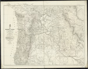
Map of the Department of the Columbia
124.
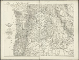
Map of the Department of the Columbia
125.
A draught of Boston Harbor by Capt. Cyprian Southake
126.
Straits of Tsugar, Japan : surveyed in the U.S. Str. John Hancock, 1855
127.
The Graphic parliamentary map showing members returned for county divisions and boroughs : their political party, and the...
128.
Map of the city & county of New York
129.
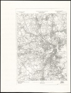
Massachusetts, Boston sheet
130.
Egypt and the basin of the Nile
131.
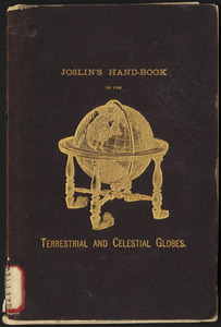
Joslin's hand-book to the terrestrial and celestial globes : how to use a globe
132.
Photo relief map of England
133.
State of Illinois
134.
State of Iowa
135.
Turkestan and the countries between the British and the Russian dominions in Asia : mapped on the basis of the surveys made by...
136.
The unique map of California
137.
Atlas of Malden City, Massachusetts
138.
Bangor : Pennsylvania
139.
Bath, Penn
140.
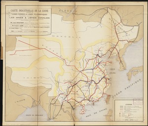
Carte industrielle de la Chine : contenant les lignes ferrées & lignes télégraphiques construites, concédées & probables,...
‹ Prev
Next ›
1
2
3
4
5
6
7
8
9
10