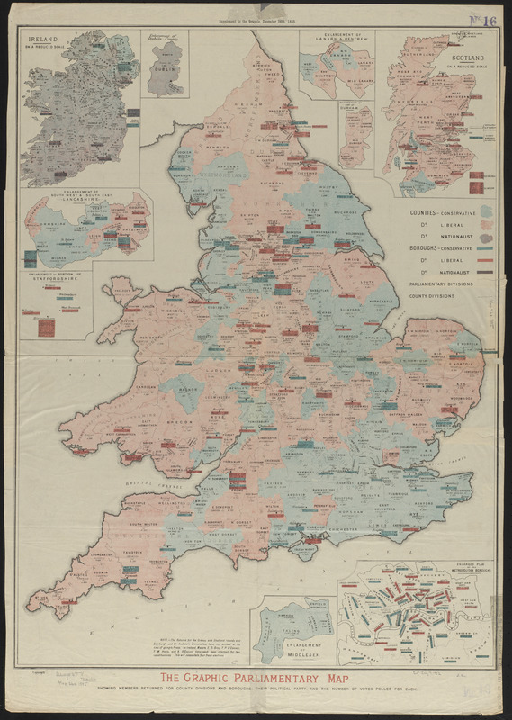
The Graphic parliamentary map showing members returned for county divisions and boroughs : their political party, and the number of votes polled for each
Item Information
- Title:
- The Graphic parliamentary map showing members returned for county divisions and boroughs : their political party, and the number of votes polled for each
- Title (uniform):
-
Graphic (London, England)
- Date:
-
1885
- Format:
-
Maps/Atlases
- Location:
-
Boston Public Library
Norman B. Leventhal Map & Education Center - Collection (local):
-
Norman B. Leventhal Map & Education Center Collection
- Subjects:
-
Elections--Great Britain
Great Britain--Administrative and political divisions--Maps
- Places:
-
United Kingdom
- Extent:
- 1 map : color ; 75 x 56 cm
- Terms of Use:
-
No known copyright restrictions.
No known restrictions on use.
- Publisher:
-
London :
Graphic
- Scale:
-
Scale approximately 1:1,000,000
- Language:
-
English
- Notes:
-
Insets: Ireland on a reduced scale -- Enlargement of Dublin County -- Enlargement of south west and south east Lancashire -- Enlargement of a portion of Staffordshire -- Enlargement of Lanark & Renfrew -- Enlargement of part of Durham -- Scotland on a reduced scale -- Enlargement of Middlesex -- Enlarged plan of the metropolitan boroughs.
"Supplement to the Graphic, December 26th, 1885."
- Identifier:
-
06_01_014864
- Call #:
-
G5751.F9 1885 .G73
- Barcode:
-
39999065707679


