Toggle navigation
LMEC Home
Exhibitions
Georeferencing
Tools for Teachers
Collections
My Favorites
Sign Up / Log In
Search
Search the map portal
Map Collection
Map Collection
Map Sets
Search
Search
Search for
Search In
All Fields
Creator
Title
Subject
Place
Search All Digital Collections
Advanced Search
185 Results
My Search
Start Over
1885
Remove constraint 1885
Filter your Search
Place
North and Central America
150
United States
108
Massachusetts
39
Costa Rica
17
Boston
16
Europe
16
Suffolk (county)
16
Virginia
9
more
Place
»
Topic
Boston (Mass.)--Maps
7
Grant, Ulysses S. (Ulysses Simpson), 1822-1885
5
Fire risk assessment--Massachusetts--Boston--Maps
4
Richmond (Va.)--History--Civil War, 1861-1865--Maps
4
Boston (Mass.)--Aerial views
3
Europe--Maps
3
North Carolina--Maps
3
Bahamas--Maps
2
more
Topic
»
Date
Date range begin
–
Date range end
Current results range from
1694
to
1925
View distribution
Creator
United States. Hydrographic Office
48
O.H. Bailey & Co
21
Franke, M. (Max)
11
Geological Survey (U.S.)
9
Ruebsam, E. A. (E. August)
9
Bachmann, John, fl. 1849-1885
8
Erni, A. (Adolphe)
7
Lesher, C. E. (Carl Eugene), 1885-
7
more
Creator
»
Format
Maps/Atlases
182
Manuscripts
3
Prints
2
Books
1
Georeferenced
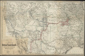
Yes
10
No
175
Collection
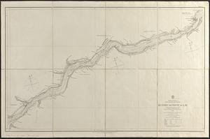
Norman B. Leventhal Map & Education Center Collection
180
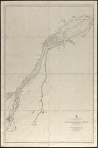
Urban Maps
60
Maritime Charts and Atlases
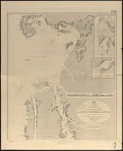
55
Boston and New England Maps
47
Lucius Beebe Memorial Library Historic Maps
1
Massachusetts Real Estate Atlases
1
Ralph Finos Map Collection at Phillips Academy
1
Sidney R. Knafel Map Collection at Phillips Academy
1
more
Collection
»
Available to use
No known restrictions
183
Search Constraints
Sort by relevance
relevance
title
date (asc)
date (desc)
Number of results to display per page
20 per page
10
per page
20
per page
50
per page
100
per page
View results as:
grid view
map view
Search Results
101.
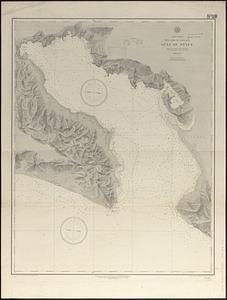
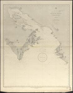
Central America, west coast of Costa Rica, Gulf of Dulce
102.
New Zealand, Middle and South Islands
103.
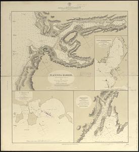
North America, east coast, harbors on the south coast of Newfoundland : republication of Brit. Admty. charts nos. 2829, 301,...
104.
The country around Herat : projected from Major Holditch's map
105.
Plan of land owned by the Aspinwall Land Company on Aspinwall Hill in Brookline, Mass
106.
North Pacific Islands
107.
Pacific Ocean, New Zealand : from surveys in H.M. ships Acheron, & Pandora
108.
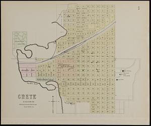
Crete, Saline Co
109.
Map showing the Atchison, Topeka and Santa Fe railroad system : with its connections
110.
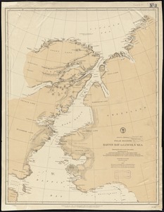
North America polar regions : Baffin Bay to Lincoln Sea, showing the most recent discoveries including those of U.S.S. Polaris...
111.
The north coast of the Gulf of Mexico, from St. Marks to Galveston
112.
South America, anchorages in Magellan Strait : from the most recent British surveys
113.
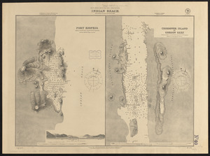
South America--south west coast--inner channels, Indian Reach : from British surveys corrected to 1881
114.
North America, River St. Lawrence above Quebec
115.
North America, River St. Lawrence above Quebec
116.
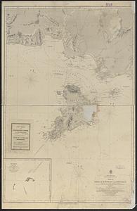
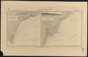
Central America, west coast of Costa Rica, Gulf of Nicoya
117.
Central America, west coast of Costa Rica, Port Culebra
118.
Birds eye view of the Soudan
119.
South America, west coast of Patagonia, channels between the Gulfs of Trinidad and of Peñas : compiled from the most recent...
120.
Topographical map of the state of Rhode Island and Providence plantations
‹ Prev
Next ›
1
2
3
4
5
6
7
8
9
10