Toggle navigation
LMEC Home
Exhibitions
Georeferencing
Tools for Teachers
Collections
My Favorites
Sign Up / Log In
Search
Search the map portal
Map Collection
Map Collection
Map Sets
Search
Search
Search for
Search In
All Fields
Creator
Title
Subject
Place
Search All Digital Collections
Advanced Search
2867 Results
My Search
Start Over
atlas
Remove constraint atlas
Filter your Search
Place
North and Central America
1,663
United States
1,001
Europe
464
Massachusetts
353
Canada
271
South America
191
Asia
190
Suffolk (county)
164
more
Place
»
Topic
Landowners--Massachusetts--Boston--Maps
115
Real property--Massachusetts--Boston--Maps
106
United States--Maps
87
Boston (Mass.)--Maps
64
United States--History--French and Indian War, 1754-1763--Maps
63
Saint Lawrence River--Maps
41
Nautical charts--Early works to 1800
39
North America--Maps--Early works to 1800
36
more
Topic
»
Date
Date range begin
–
Date range end
Current results range from
1482
to
2023
View distribution
Creator
United States. Hydrographic Office
583
Des Barres, Joseph F. W. (Joseph Frederick Wallet), 1722-1824
118
Ptolemy, 2nd cent
100
Bromley, George Washington
99
Bromley, Walter Scott
97
G.W. Bromley & Co.
75
Carey, Mathew, 1760-1839
74
Paullin, Charles Oscar, 1868 or 1869-1944
70
more
Creator
»
Format
Maps/Atlases
2,851
Manuscripts
58
Books
37
Prints
8
Documents
5
Drawings/Illustrations
1
Georeferenced
Yes
142
No
2,725
Collection
Norman B. Leventhal Map & Education Center Collection
2,410
Maritime Charts and Atlases
1,167
American Revolutionary War-Era Maps
504
Boston and New England Maps
382
Urban Maps
255
Massachusetts Real Estate Atlases
144
William L. Clements Library Collection
92
Mapping Boston Collection
61
more
Collection
»
Available to use
No known restrictions
2,316
Creative Commons license
158
Search Constraints
Sort by relevance
relevance
title
date (asc)
date (desc)
Number of results to display per page
20 per page
10
per page
20
per page
50
per page
100
per page
View results as:
grid view
map view
Search Results
1161.
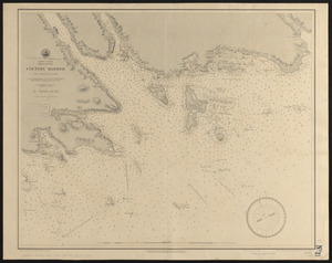
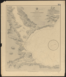
Dominion of Canada, Nova Scotia, Country Harbor : from a British survey in 1855
1162.
Dominion of Canada, Nova Scotia, Guysborough Harbor (Chedabucto Bay) : from a British survey in 1850
1163.
Dominion of Canada, Nova Scotia, Ship Harbor and adjacent anchorages : from a British survey in 1854
1164.
Dominion of Canada, Nova Scotia, Whitehaven : from a British survey in 1855
1165.
Dominion of Canada, Prince Edward Island, Hillsborough Bay and Charlottetown Harbor : from British surveys in 1842 & 43
1166.
A draught of New York from the Hook to New York Town
1167.
A draught of the Bay of Honda
1168.
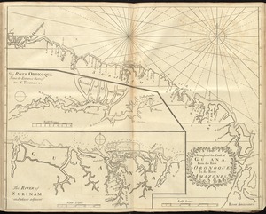
A draught of the coast of Guiana, from the river Oronoque to the river Amazones
1169.
A draught of Virginia from the Capes to York in York River and to Kuiquotan or Hamton in James River
1170.
East India Archipelago, Singapore roads : from British surveys in 1864 : republication of Brit. Admty. chart no. 1995, with...
1171.
East India Archipelago, Singapore Strait, New Harbor of Singapore : republication of the Brit. Admty. chart no. 2023 :...
1172.
East-coast of Newfoundland, harbors & anchorages of Fogo Island : republication of Brit. Admty. chart no. 291
1173.
East-India Archipelago, Singapore Strait : from British and Dutch surveys, 1865 to 1869 : republication of the British Admty....
1174.
Eldridge's chart of Long Island Sound from Newport to New York
1175.
Endermo Harbor, Island of Jesso
1176.
England--south coast, approaches to Falmouth : republished from the British Admiralty chart of 1872
1177.
England--south coast, Portland Harbor : republished from British Admy. chart no. 2268
1178.
Erie Harbor
1179.
An exact chart of the river St. Laurence, from Fort Frontenac to the island of Anticosti shewing the soundings, rocks, shoals...
1180.
An exact draught of the gulf of Darien & the coast to Porto Bello with Panama in the south sea & the Scotch settlement in...
‹ Prev
Next ›
1
2
…
55
56
57
58
59
60
61
62
63
…
143
144