East-coast of Newfoundland, harbors & anchorages of Fogo Island : republication of Brit. Admty. chart no. 291
Item Information
- Title:
- East-coast of Newfoundland, harbors & anchorages of Fogo Island : republication of Brit. Admty. chart no. 291
- Title (alt.):
-
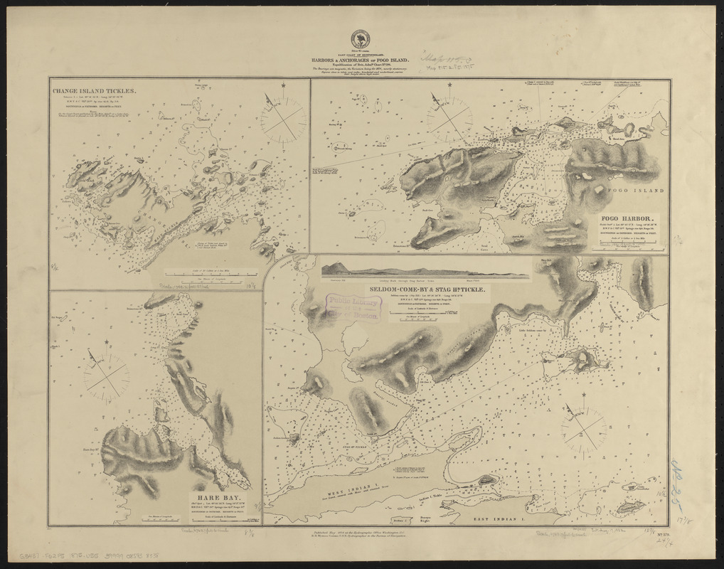
Harbors & anchorages of Fogo Island
- Issuing body:
- United States. Hydrographic Office
- Date:
-
1875
- Format:
-
Maps/Atlases
- Location:
-
Boston Public Library
Norman B. Leventhal Map & Education Center - Collection (local):
-
Norman B. Leventhal Map & Education Center Collection
- Subjects:
-
Nautical charts--Newfoundland and Labrador--Fogo Island (Island)
Change Island Tickle (N.L.)--Maps
Deep Bay (N.L.)--Maps
Fogo Harbour (N.L.)--Maps
Seldom Harbour (N.L.)--Maps
Stag Harbour Run (N.L.)--Maps
- Places:
-
CanadaNewfoundland and Labrador (province)Fogo
Change Islands Tickle
Deep Bay
Seldom Harbour
Stag Harbour Tickle
- Extent:
- 4 maps on 1 sheet ; 45 x 62 cm
- Terms of Use:
-
No known copyright restrictions.
No known restrictions on use.
- Publisher:
-
Washington, D.C. :
Hydrographic Office
- Scale:
-
Scales differ
- Language:
-
English
- Table of Contents:
-
Change Island Tickles
Fogo Harbor
Hare Bay
Seldom-Come-By & Stag Hr. Tickle.
- Notes:
-
Relief shown by hachures and spot heights. Depths shown by soundings and form lines.
Includes view of Leading mark through Stag Harbor Tickle.
"Cor. (11.75)."
- Identifier:
-
06_01_015564
- Call #:
-
G9096.P5 svar .U55
- Barcode:
-
39999085938338


