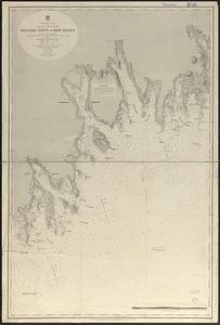
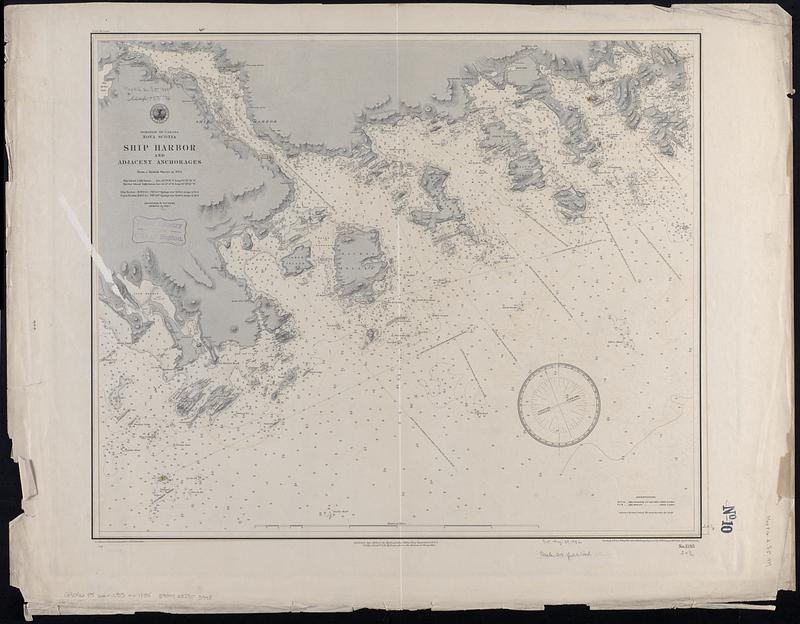
Dominion of Canada, Nova Scotia, Ship Harbor and adjacent anchorages : from a British survey in 1854
Item Information
- Title:
- Dominion of Canada, Nova Scotia, Ship Harbor and adjacent anchorages : from a British survey in 1854
- Issuing body:
- United States. Hydrographic Office
- Engraver:
- Dougal, W. M. (William M.)
- Engraver:
- Franke, M. (Max)
- Draftsman:
- Klakring, A. (Alfred)
- Engraver:
- Ruebsam, E. A. (E. August)
- Draftsman:
- Wimpffen, L. F. von (Lebreclit Felix von)
- Name on Item:
-
drawn by L.F. von Wimpffen amd A. Klakring ; engraved by W.M. Dougal, M. Franke and E.A. Ruebsam
- Date:
-
1889
- Format:
-
Maps/Atlases
- Genre:
-
Nautical charts
- Location:
-
Boston Public Library
Norman B. Leventhal Map & Education Center - Collection (local):
-
Norman B. Leventhal Map & Education Center Collection
- Subjects:
-
Ship Harbour (N.S. : Harbor)--Maps
Coasts--Nova Scotia--Maps
Navigation--Nova Scotia--Ship Harbour (Harbor)
- Places:
-
CanadaNova Scotia (province)
Ship Harbour
- Extent:
- 1 map ; 52 x 62 cm
- Terms of Use:
-
No known copyright restrictions.
No known restrictions on use.
- Publisher:
-
[Washington, D.C.] :
Hydrographic Office
- Scale:
-
Scale approximately 1:37,500
- Language:
-
English
- Notes:
-
Relief shown by shading and spot heights. Depths shown by soundings and isolines.
- Identifier:
-
06_01_017037
- Call #:
-
G9096.P5 svar .U55
- Barcode:
-
39999085953998