Toggle navigation
LMEC Home
Exhibitions
Georeferencing
Tools for Teachers
Collections
My Favorites
Sign Up / Log In
Search
Search the map portal
Map Collection
Map Collection
Map Sets
Search
Search
Search for
Search In
All Fields
Creator
Title
Subject
Place
Search All Digital Collections
Advanced Search
2261 Results
My Search
Start Over
london
Remove constraint london
Filter your Search
Place
North and Central America
1,479
United States
921
Europe
363
Canada
347
North America
194
New York
128
Massachusetts
111
New England
104
more
Place
»
Topic
North America--Maps--Early works to 1800
137
Coasts--Nova Scotia--Maps
64
New England--Maps--Early works to 1800
57
United States--History--French and Indian War, 1754-1763--Maps
57
United States--History--French and Indian War, 1754-1763--Maps, Manuscript--Early works to 1800
56
United States--Maps--Early works to 1800
54
United States--History--Revolution, 1775-1783--Maps
40
Nova Scotia--Maps--Early works to 1800
39
more
Topic
»
Date
Date range begin
–
Date range end
Current results range from
1624
to
1999
View distribution
Creator
Des Barres, Joseph F. W. (Joseph Frederick Wallet), 1722-1824
242
Jefferys, Thomas, -1771
167
George, III, King of Great Britain, 1738-1820
149
George, IV, King of Great Britain, 1762-1830
148
Sayer, Robert, 1725-1794
115
Faden, William, 1749-1836
109
Moll, Herman, d. 1732
72
Robert Sayer and John Bennett (Firm)
57
more
Creator
»
Format
Maps/Atlases
2,219
Manuscripts
161
Prints
23
Drawings/Illustrations
15
Books
4
Objects/Artifacts
1
Georeferenced
Yes
137
No
2,124
Collection
American Revolutionary War-Era Maps
1,355
Norman B. Leventhal Map & Education Center Collection
1,305
Maritime Charts and Atlases
263
British Library Collection
163
William L. Clements Library Collection
160
Boston and New England Maps
152
Richard H. Brown Revolutionary War Map Collection at Mount Vernon
146
MacLean Collection Map Library
140
more
Collection
»
Available to use
No known restrictions
1,271
Creative Commons license
569
Search Constraints
Sort by relevance
relevance
title
date (asc)
date (desc)
Number of results to display per page
20 per page
10
per page
20
per page
50
per page
100
per page
View results as:
grid view
map view
Search Results
1061.
Africæ, described, the manners of their habits and buildings, newly done into English
1062.
A new & accurate map of the provinces of North & South Carolina Georgia &c
1063.
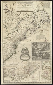
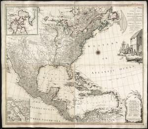
A new and exact map of the dominions of the King of Great Britain on ye continent of North America : containing Newfoundland,...
1064.
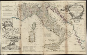
A new map of Italy distinguishing all the sovereignties in it, whether states, kingdoms, dutchies, principalities, republicks,...
1065.
To His Most Serene and August Majesty Peter Alexovitz absolute lord of Russia &c. this map of Moscovy, Poland, Little Tartary,...
1066.
A new and correct map of North America, with the West India Islands : divided according to the last Treaty of Peace, concluded...
1067.
A new and correct map of North America, with the West India Islands : divided according to the last Treaty of Peace, concluded...
1068.
America : with those known parts in that unknowne worlde both people and manner of buildings discribed and inlarged
1069.
An exact chart of the river St. Laurence, from Fort Frontenac to the island of Anticosti shewing the soundings, rocks, shoals...
1070.
Guadaloupe, done from actual surveys and observations of the English : whilst the island was in their possession
1071.
A plan of the city and environs of New York in North America
1072.
Amerique Septentrionale avec les routes, distances en miles, villages et etablissements françois et anglois = North America
1073.
Amerique Septentrionale avec les routes, distances en miles, villages et etablissements françois et anglois = North America
1074.
Tobago from actual surveys and observations
1075.
[View of the country round Boston taken from Beacon hill]
1076.
[View of the country round Boston taken from Beacon hill]
1077.
[View of the country round Boston taken from Beacon hill]
1078.
An authentic plan of the River St. Laurence from Sillery to the fall of Montmorenci, with the operations of the siege of Quebec...
1079.
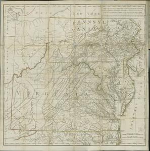
A map of the country between Albemarle Sound, and Lake Erie, comprehending the whole of Virginia, Maryland, Delaware and...
1080.
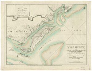
A plan of the attack of Fort Sulivan, near Charles Town in South Carolina : by a squadron of His Majesty's ships, on the 28th...
‹ Prev
Next ›
1
2
…
50
51
52
53
54
55
56
57
58
…
113
114


![[View of the country round Boston taken from Beacon hill]](https://bpldcassets.blob.core.windows.net/derivatives/images/commonwealth:6108vv93v/image_thumbnail_300.jpg)
![[View of the country round Boston taken from Beacon hill]](https://bpldcassets.blob.core.windows.net/derivatives/images/commonwealth:6108vv97z/image_thumbnail_300.jpg)
![[View of the country round Boston taken from Beacon hill]](https://bpldcassets.blob.core.windows.net/derivatives/images/commonwealth:6108vv95d/image_thumbnail_300.jpg)