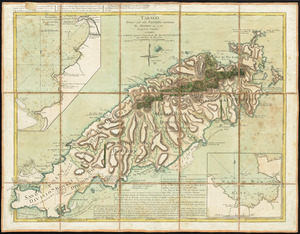
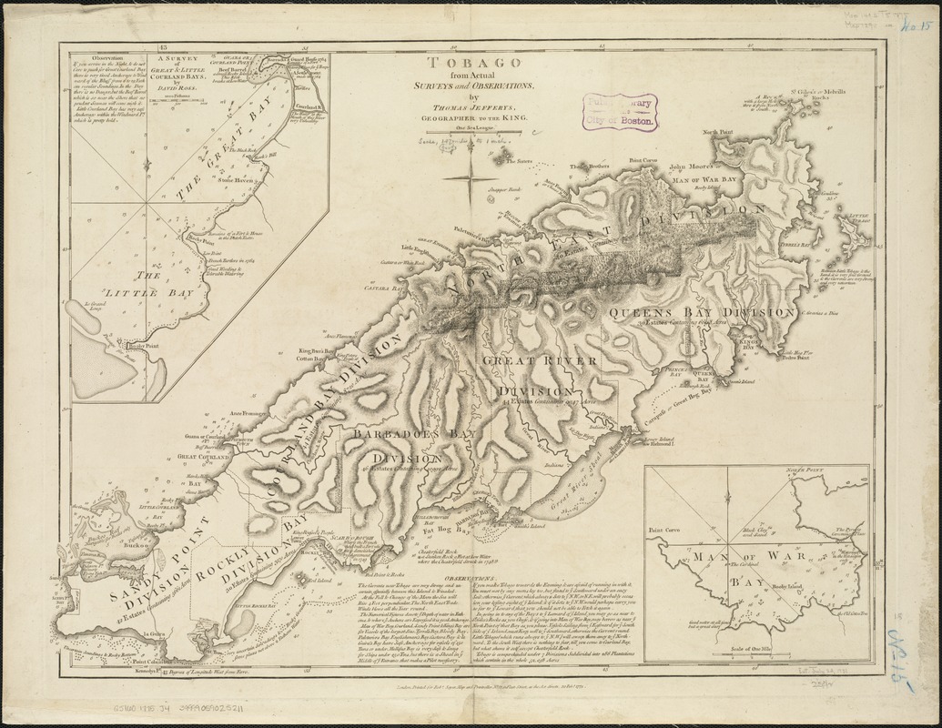
Tobago from actual surveys and observations
This map is also available in American Revolutionary Geographies Online (ARGO), a collections portal especially built for material relating to the American Revolutionary War Era. Visit ARGO to learn more about this item and explore the historical geography of North America in the late eighteenth century.
Item Information
- Title:
- Tobago from actual surveys and observations
- Creator:
- Jefferys, Thomas, d. 1771
- Name on Item:
-
by Thomas Jefferys.
- Date:
-
1775
- Format:
-
Maps/Atlases
- Location:
-
Boston Public Library
Norman B. Leventhal Map & Education Center - Collection (local):
-
Norman B. Leventhal Map & Education Center Collection
- Subjects:
-
Tobago (Trinidad and Tobago)--Maps--Early works to 1800
Tobago (Trinidad and Tobago)--Administrative and political divisions--Maps--Early works to 1800
- Places:
-
Trinidad and TobagoTobago (island)
- Extent:
- 1 map ; 46 x 62 cm.
- Terms of Use:
-
No known copyright restrictions.
No known restrictions on use.
- Scale:
-
Scale [ca. 1:63,360]
- Language:
-
English
- Notes:
-
Relief shown by hachures; depth shown by soundings.
Shows administrative boundaries and cultural features.
Includes descriptive text and inset maps "Man of War Bay" and "A survey of Great & Little Courland Bays, by David Ross."
"Printed for Robt. Sayer, Map and Printseller, no. 53 in Fleet Street, as the Act directs 20 Feby. 1775."
Prime meridian: Ferro.
Appears in the author's West-India atlas. London: Robert Sayer and John Bennet, 1783.
Cataloging, conservation, and digitization made possible in part by The National Endowment for the Humanities: Exploring the human endeavor.
- Identifier:
-
06_01_006374
- Call #:
-
G5160 1775 .J44
- Barcode:
-
39999059025211