Toggle navigation
LMEC Home
Exhibitions
Georeferencing
Tools for Teachers
Collections
My Favorites
Sign Up / Log In
Search
Search the map portal
Map Collection
Map Collection
Map Sets
Search
Search
Search for
Search In
All Fields
Creator
Title
Subject
Place
Search All Digital Collections
Advanced Search
13385 Results
Filter your Search
Place
North and Central America
10,111
United States
8,249
Massachusetts
2,691
Suffolk (county)
1,664
Boston
1,621
Europe
1,386
Canada
949
New York
640
more
Place
»
Topic
Boston (Mass.)--Maps
741
City planning--Massachusetts--Boston--Maps
418
United States--History--Revolution, 1775-1783--Maps
329
United States--Maps
315
Urban renewal--Massachusetts--Boston--Maps
254
Real property--Massachusetts--Boston--Maps
252
Massachusetts--Maps
219
Insurance surveys
197
more
Topic
»
Date
Date range begin
–
Date range end
Current results range from
1482
to
2023
View distribution
Creator
United States. Hydrographic Office
595
Boston Redevelopment Authority
403
Des Barres, Joseph F. W. (Joseph Frederick Wallet), 1722-1824
247
Royal United Services Institute for Defence and Security Studies
160
Jefferys, Thomas, -1771
154
George, III, King of Great Britain, 1738-1820
152
George, IV, King of Great Britain, 1762-1830
151
O.H. Bailey & Co
148
more
Creator
»
Format
Maps/Atlases
13,205
Manuscripts
985
Prints
102
Books
49
Drawings/Illustrations
44
Photographs
15
Objects/Artifacts
13
Documents
7
more
Format
»
Georeferenced
Yes
979
No
12,406
Collection
Norman B. Leventhal Map & Education Center Collection
8,891
American Revolutionary War-Era Maps
3,305
Boston and New England Maps
2,804
Urban Maps
2,397
Maritime Charts and Atlases
1,150
William L. Clements Library Collection
910
Library of Congress Collection
618
Boston Redevelopment Authority Collection
475
more
Collection
»
Available to use
No known restrictions
9,952
Creative Commons license
1,677
Search Constraints
Sort by relevance
relevance
title
date (asc)
date (desc)
Number of results to display per page
20 per page
10
per page
20
per page
50
per page
100
per page
View results as:
grid view
map view
Search Results
10441.
Pocket map showing the railroads, street railways, manufactories, deep water connections, blocks and subdivisions of the city...
10442.
Podrobnaia militernaia karta, po granits Rossii s Turtsieiu
10443.
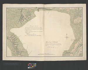
Point Levi. Parish of St. Charles
10444.
The Point of Pines, Revere, Mass : on the Atlantic Ocean, eight miles north east of Boston : the most beautiful sea shore...
10445.
Poland
10446.
Poland
10447.
Poland & Lithuania
10448.
Poland, shewing the claims of Russia, Prussia & Austria, until the late depredations, the extent of which cannot as yet be...
10449.
Poli Arctici, et circumiacentium terrarum descriptio novissima
10450.
Political map of California. 1888
10451.
Political map of Connecticut 1888 ; Political map of New York 1888
10452.
Political map of Europe
10453.
Political map of Indiana. 1888
10454.
Political map of Michigan 1888
10455.
Political map of New Jersey 1888
10456.
Political map of the Balkan States
10457.
Political map of the United States and territories. 1888
10458.
Political map of the world, April 2001
10459.
Political map of West Virginia 1888
10460.
Politisch-militärische karte von Süd-Afrika : zur veranschaulichung der kämpfe zwischen Buren und Engländern bis zur Gegenwart
‹ Prev
Next ›
1
2
…
519
520
521
522
523
524
525
526
527
…
669
670