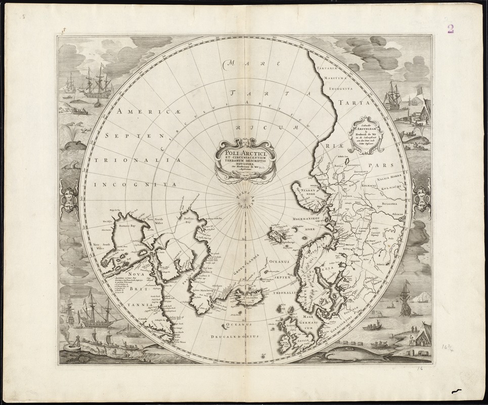
Poli Arctici, et circumiacentium terrarum descriptio novissima
Item Information
- Title:
- Poli Arctici, et circumiacentium terrarum descriptio novissima
- Title (alt.):
-
Collection of old maps
- Creator:
- Wit, Frederik de.
- Name on Item:
-
per Fredericum de Wit, Amstelodami.
- Date:
-
[1676]
- Format:
-
Maps/Atlases
- Location:
-
Boston Public Library
Norman B. Leventhal Map & Education Center - Collection (local):
-
Norman B. Leventhal Map & Education Center Collection
- Subjects:
-
Whaling--Arctic regions--17th century--Pictorial works
Arctic regions--Maps--Early works to 1800
North Pole--Maps--Early works to 1800
- Places:
-
Arctic (area)
- Extent:
- 1 map ; 42 cm. in diam., on sheet 53 x 62 cm.
- Terms of Use:
-
No known copyright restrictions.
No known restrictions on use.
- Publisher:
-
Gedruckt 't Amsteldam :
By Frederick de Wit in de Calverstraet aen den Dam in Witte Pascaert
- Scale:
-
Scale [ca. 1:21,000,000]
- Language:
-
Latin
- Notes:
-
Relief shown pictorially.
Publication date from Burden.
Includes decorative cartouches and illustrations of whaling in margins.
From: Atlas [Zeekarten]. Tot Amsterdam : bij Frederick de Wit in de Calverstraet bij den Dam inde Witte Paskaert, [1676?].
Cataloging, conservation, and digitization made possible in part by The National Endowment for the Humanities: Exploring the human endeavor.
Part of composite portfolio atlas with title "Collection of old maps."
- Notes (date):
-
This date is inferred.
- Identifier:
-
06_01_008686
- Call #:
-
G1015 .C65 1630
- Barcode:
-
30000003827750