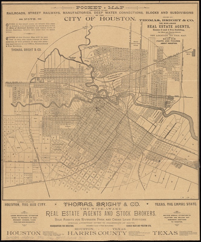
Pocket map showing the railroads, street railways, manufactories, deep water connections, blocks and subdivisions of the city of Houston
Item Information
- Title:
- Pocket map showing the railroads, street railways, manufactories, deep water connections, blocks and subdivisions of the city of Houston
- Title (alt.):
-
Railroads, street railways, manufactories, deep water connections, blocks and subdivisions of the city of Houston
City of Houston
Pocket map with facts and figures about Houston, the railroad, manufacturing and commercial hub of Texas, the Empire State
- Creator:
- Thomas, W. W.
- Name on Item:
-
the original drawing of this map was made, and these facts and figures compiled, by W.W. Thomas.
- Date:
-
[1890]
- Format:
-
Maps/Atlases
- Location:
-
Boston Public Library
Norman B. Leventhal Map & Education Center - Collection (local):
-
Norman B. Leventhal Map & Education Center Collection
- Subjects:
-
Railroads--Texas--Houston--Maps
Real property--Texas--Houston--Maps
Landowners--Texas--Houston--Maps
Houston (Tex.)--Maps
- Places:
-
TexasHarris (county)Houston
- Extent:
- 1 map ; 35 x 36 cm., folded to 15 x 8 cm.
- Terms of Use:
-
No known copyright restrictions.
No known restrictions on use.
- Publisher:
-
Houston, Tex :
Thomas, Bright & Co.
- Scale:
-
Scale [ca. 1:22,500]
- Language:
-
English
- Notes:
-
Shows lots and some landowners.
Text on verso.
- Notes (date):
-
This date is inferred.
- Identifier:
-
06_01_011318
- Call #:
-
G4034.H8G46 1890 .T46
- Barcode:
-
39999065683011


