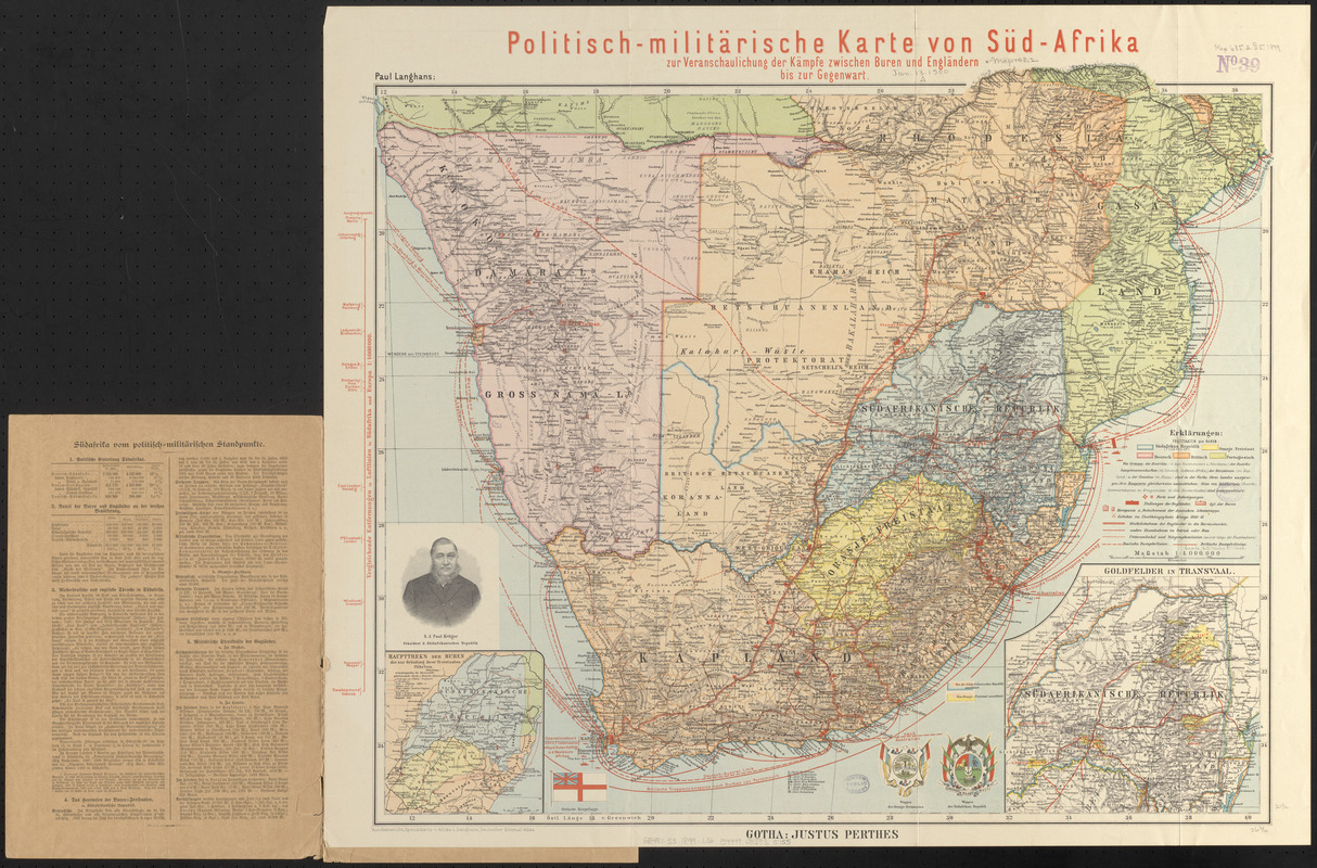
Politisch-militärische karte von Süd-Afrika : zur veranschaulichung der kämpfe zwischen Buren und Engländern bis zur Gegenwart
Item Information
- Title:
- Politisch-militärische karte von Süd-Afrika : zur veranschaulichung der kämpfe zwischen Buren und Engländern bis zur Gegenwart
- Cartographer:
- Langhans, Paul, 1867-1952
- Publisher:
- Justus Perthes (Firm : Gotha, Germany)
- Name on Item:
-
Paul Langhans
- Date:
-
1899
- Format:
-
Maps/Atlases
- Location:
-
Boston Public Library
Norman B. Leventhal Map & Education Center - Collection (local):
-
Norman B. Leventhal Map & Education Center Collection
- Subjects:
-
South African War, 1899-1902--Maps
Transvaal (South Africa)--History--War of 1880-1881--Maps
Gold mines and mining--South Africa--Transvaal--Maps
Africa, Southern--Maps
- Places:
-
Southern Africa (area)
- Extent:
- 1 map : color ; 57 x 67 cm, folded in cover 34 x 24 cm
- Terms of Use:
-
No known copyright restrictions.
No known restrictions on use.
- Publisher:
-
Gotha :
Justus Perthes
- Scale:
-
Scale 1:4,000,000
- Language:
-
German
- Notes:
-
Relief shown by hachures.
Shows military information for the South African War.
Includes illustrations of emblems and flag.
Insets: Haupttreks der Buren die zur gründung ihrer Freistaaten führten -- Goldfelder in Transvaal.
Includes illustration of S.J. Paul Kruger.
"Aus. habenicht, spezialkarte v. Afrika u. Langhans, Deutsche kolonial-atlas."
Text on inside of front cover.
Date of publication from cover.
- Identifier:
-
06_01_015363
- Call #:
-
G8481.S3 1899 .L36
- Barcode:
-
39999085935755