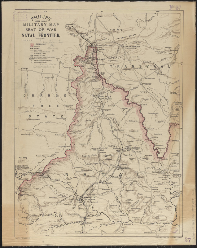
Philips' large scale military map of the seat of war on the Natal frontier
Item Information
- Title:
- Philips' large scale military map of the seat of war on the Natal frontier
- Cartographer:
- George Philip & Son
- Publisher:
- George Philip & Son
- Date:
-
[1899]
- Format:
-
Maps/Atlases
- Location:
-
Boston Public Library
Norman B. Leventhal Map & Education Center - Collection (local):
-
Norman B. Leventhal Map & Education Center Collection
- Subjects:
-
South African War, 1899-1902--Maps
South Africa--History--Maps
KwaZulu-Natal (South Africa)--Maps
- Places:
-
South AfricaKwaZulu/Natal (province)
- Extent:
- 1 map : color ; 60 x 46 cm
- Terms of Use:
-
No known copyright restrictions.
No known restrictions on use.
- Publisher:
-
London :
George Philip and Son
- Scale:
-
Scale approximately 1:316,800
- Language:
-
English
- Notes:
-
Relief shown by shading and spot heights.
Also shows sites of other historical battles.
- Notes (date):
-
This date is inferred.
- Identifier:
-
06_01_015382
- Call #:
-
G8501.S3 1899 .G46
- Barcode:
-
39999085935557


