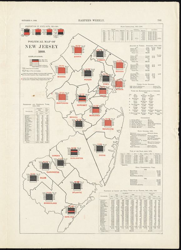
Political map of New Jersey 1888
Item Information
- Title:
- Political map of New Jersey 1888
- Cartographer:
- Campbell-Copeland, T. (Thomas)
- Publisher:
- Harper & Brothers
- Name on Item:
-
designed by T. Campbell-Copeland
- Date:
-
1888
- Format:
-
Maps/Atlases
- Location:
-
Boston Public Library
Norman B. Leventhal Map & Education Center - Collection (local):
-
Norman B. Leventhal Map & Education Center Collection
- Subjects:
-
Voting--New Jersey--Maps
- Places:
-
New Jersey
- Extent:
- 1 map : color ; 59 x 43 cm
- Terms of Use:
-
No known copyright restrictions.
No known restrictions on use.
- Publisher:
-
New York :
Harper & Brothers
- Scale:
-
Scale not given
- Language:
-
English
- Notes:
-
From the "Battle-ground of the presidential election" in the October 6, 1888 issue of Harper's Weekly.
Voting results represented by color-coded bars for the years 1872, 1876, 1880, 1884, and 1888. 1888 bars are blank, to be filled in after the election.
- Identifier:
-
06_01_008260
- Call #:
-
G3701.F9 1888 .C36x
- Barcode:
-
39999065651083


