Toggle navigation
LMEC Home
Exhibitions
Georeferencing
Tools for Teachers
Collections
My Favorites
Sign Up / Log In
Search
Search the map portal
Map Collection
Map Collection
Map Sets
Search
Search
Search for
Search In
All Fields
Creator
Title
Subject
Place
Search All Digital Collections
Advanced Search
111 Results
My Search
Start Over
new brunswick
Remove constraint new brunswick
Filter your Search
Place
North and Central America
103
Canada
82
Province of New Brunswick
51
United States
42
Maine
17
Nova Scotia
12
New England
9
Saint John
9
more
Place
»
Topic
New Brunswick--Maps
11
Maine--Maps
8
New England--Maps
7
Canada--Boundaries--United States--Maps
6
Coasts--New Brunswick--Maps
6
Fort Cumberland (N.B.)--Maps, Manuscript--Early works to 1800
6
New Brunswick--Maps--Early works to 1800
6
Nova Scotia--Maps
6
more
Topic
»
Date
Date range begin
–
Date range end
Current results range from
1662
to
1992
View distribution
Creator
Amherst, Jeffery Amherst, Baron, 1717-1797
9
Royal United Services Institute for Defence and Security Studies
9
Des Barres, Joseph F. W. (Joseph Frederick Wallet), 1722-1824
8
George, III, King of Great Britain, 1738-1820
8
George, IV, King of Great Britain, 1762-1830
8
Bruce, Robert George
7
Parr, John, 1725-1791
6
United States. Hydrographic Office
6
more
Creator
»
Format
Maps/Atlases
111
Manuscripts
16
Objects/Artifacts
1
Georeferenced
Yes
5
No
106
Collection
Norman B. Leventhal Map & Education Center Collection
61
American Revolutionary War-Era Maps
58
British Library Collection
17
Boston and New England Maps
14
Maritime Charts and Atlases
11
Library of Congress Collection
10
Urban Maps
10
William L. Clements Library Collection
9
more
Collection
»
Available to use
No known restrictions
60
Creative Commons license
33
Search Constraints
Sort by relevance
relevance
title
date (asc)
date (desc)
Number of results to display per page
20 per page
10
per page
20
per page
50
per page
100
per page
View results as:
grid view
map view
Search Results
81.
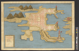
Plan von Fort Cumberland auf der insel St. Laurenti
82.
A plan of the rivers Scoodic and Magaguadavic with their principal branches including the Bay of Passamaquoddy and the adjacent...
83.
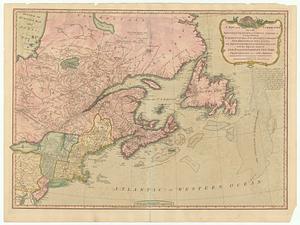
An exact map of Nova Scotia, Newfoundland, gulf and river St. Laurence, and coast of Labrador from the latest observations 1777
84.
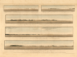
The Wolves, a cluster of isles lying s.e. near 3 leagues from Pasamaquady Bay ... ; Grand Manan Island ... ; A view of the...
85.
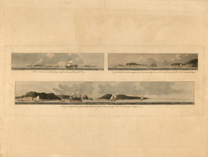
The Wolves, (a cluster of isles) lying s.e. off the entrance of Passamaquadi Bay ; Grand Manan Island ... ; View of the shore...
86.
A new & exact map of the electorate of Brunswick-Lunenburg and ye rest of ye Kings dominions in Germany : very much improved by...
87.
North America, Dominion of Canada, Gulf of St. Lawrence, Prince Edward Island and adjacent coasts, from Sea Wolf Island to...
88.
Chart of the Bay of Fundy from Machias Bay to 64°35' west longitude
89.
G. Woolworth Colton's railroad, township & distance map of New England : with adjacent portions of New York, Canada & New...
90.
A map of Upper and Lower Canada : with part of the United States adjoining, comprising the present seat of war
91.
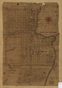
The above plan is a discription of a new township called Royalsborough in the county of Cumberland : bounded southeasterly on...
92.
A new and correct map of the British colonies in North America : comprehending eastern Canada with the province of Quebec, New...
93.
A map of the New England states : Maine, New Hampshire, Vermont, Massachusetts, Rhode Island & Connecticut, with the adjacent...
94.
A map of the New England states : Maine, New Hampshire, Vermont, Massachusetts, Rhode Island & Connecticut, with the adjacent...
95.
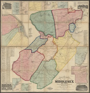
Map of the County of Middlesex, New Jersey
96.
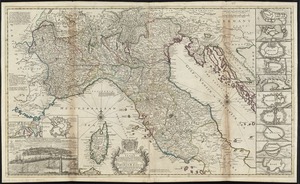
A new map of the upper part of Italy containing ye principality of Piemont ye Dutchies of Savoy, Milan, Parma, Mantua, Modena,...
97.
Plan of a rout undertaken in winter, Jany. 26th : from Quebec, the capital of Canada, to the frontier settlements of the...
98.
A plan of New York Island, and part of Long Island, with the circumjacent country, as far as Dobbs's Ferry to the north, and...
99.
Plan of ground about Wilmington
100.
This plan of Kennebeck & Sagadahock Rivers & country adjacent
‹ Prev
Next ›
1
2
3
4
5
6