Toggle navigation
LMEC Home
Exhibitions
Georeferencing
Tools for Teachers
Collections
My Favorites
Sign Up / Log In
Search
Search the map portal
Map Collection
Map Collection
Map Sets
Search
Search
Search for
Search In
All Fields
Creator
Title
Subject
Place
Search All Digital Collections
Advanced Search
163 Results
My Search
Start Over
1860
Remove constraint 1860
Filter your Search
Place
North and Central America
113
United States
94
Europe
32
Massachusetts
27
Canada
14
Boston
13
Suffolk (county)
13
Asia
8
more
Place
»
Topic
Boston (Mass.)--Maps
12
New England--Maps
6
United States--Maps
6
Canada--Boundaries--United States--Maps
5
United States--Boundaries--Canada--Maps
5
Southern States--Maps
4
Switzerland--Maps
4
United States--History--Civil War, 1861-1865--Maps
4
more
Topic
»
Date
Date range begin
–
Date range end
Current results range from
1702
to
1932
View distribution
Creator
Bartholomew, J. G. (John George), 1860-1920
10
Moore, John Bassett, 1860-1947
8
United States. Congress (53rd, 2nd session : 1893-1894). House
8
E.P. Dutton (Firm)
6
United States. Hydrographic Office
6
Boston (Mass.). Engineering Dept
4
J.M. Dent & Sons
4
United States Coast Survey
4
more
Creator
»
Format
Maps/Atlases
160
Manuscripts
6
Prints
2
Drawings/Illustrations
1
Posters
1
Georeferenced
Yes
24
No
139
Collection
Norman B. Leventhal Map & Education Center Collection
158
Boston and New England Maps
32
Urban Maps
28
Maritime Charts and Atlases
15
American Revolutionary War-Era Maps
2
Mapping Boston Collection
2
American Antiquarian Society Collection
1
Lucius Beebe Memorial Library Historic Maps
1
more
Collection
»
Available to use
No known restrictions
155
Creative Commons license
4
Search Constraints
Sort by relevance
relevance
title
date (asc)
date (desc)
Number of results to display per page
20 per page
10
per page
20
per page
50
per page
100
per page
View results as:
grid view
map view
Search Results
81.
Thunder Bay, Lake Huron
82.
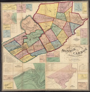
Map of the counties of Monroe and Carbon, Pennsylvania
83.
Dinsmore's new railroad map of the United States and the Canadas, showing all the railroads completed and in progress,...
84.
Plan of Boston
85.
Cummings' map of Columbia and Montour counties, Penn'a : from actual surveys
86.
New map of the vicinity of Boston, with the dates of settlement and distance from the capital
87.
British Isles and Ireland
88.
Johnson's new rail road & county copper plate map of the Southern States from the latest and best information
89.
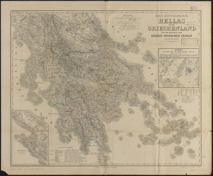
Das königreich Hellas oder Griechenland und die Republik der Sieben Ionischen Inseln (Ephtánisos)
90.
Bacon's map of Europe
91.
Bacon's map of Europe
92.
China
93.
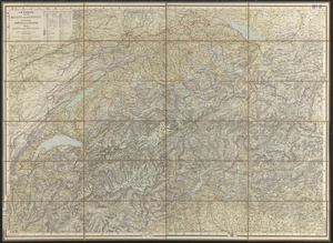
Dritte karte der Schweiz = Troisième carte de la Suisse = Terza carta della Suizzera
94.
Eastern Virginia from Fredericksburg to Richmond
95.
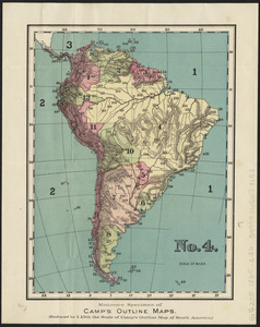
No. 4 : [South America]
96.
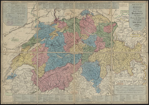
Petite carte de la Suisse pour les écoles = Karte von der Schweiz für schulen = Carta della Svizzera per le scuole
97.
4 Kinten
98.
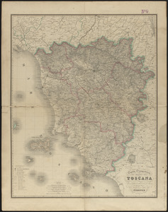
Carta geometrica della Toscana
99.
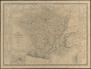
Carte de France indiquant les chemins de fer et les routes, avec les distances en kilomètres
100.
Eclipse Harbor, Labrador
‹ Prev
Next ›
1
2
3
4
5
6
7
8
9