Toggle navigation
LMEC Home
Exhibitions
Georeferencing
Tools for Teachers
Collections
My Favorites
Sign Up / Log In
Search
Search the map portal
Map Collection
Map Collection
Map Sets
Search
Search
Search for
Search In
All Fields
Creator
Title
Subject
Place
Search All Digital Collections
Advanced Search
13680 Results
My Search
Start Over
Date facet yearly ssim
1842
Remove constraint Date facet yearly ssim: <span class='single'>1842</span>
Filter your Search
Place
North and Central America
10,344
United States
8,475
Massachusetts
2,789
Suffolk (county)
1,677
Boston
1,633
Europe
1,415
Canada
950
New York
649
more
Place
»
Topic
Boston (Mass.)--Maps
747
City planning--Massachusetts--Boston--Maps
418
United States--History--Revolution, 1775-1783--Maps
329
United States--Maps
322
Real property--Massachusetts--Boston--Maps
254
Urban renewal--Massachusetts--Boston--Maps
254
Massachusetts--Maps
231
Insurance surveys
197
more
Topic
»
Date
Date range begin
–
Date range end
Current results range from
1482
to
2023
View distribution
Creator
United States. Hydrographic Office
597
Boston Redevelopment Authority
404
Des Barres, Joseph F. W. (Joseph Frederick Wallet), 1722-1824
247
Royal United Services Institute for Defence and Security Studies
160
Jefferys, Thomas, -1771
154
George, III, King of Great Britain, 1738-1820
152
George, IV, King of Great Britain, 1762-1830
151
O.H. Bailey & Co
148
more
Creator
»
Format
Maps/Atlases
13,499
Manuscripts
985
Prints
102
Books
49
Drawings/Illustrations
44
Photographs
15
Objects/Artifacts
13
Documents
7
more
Format
»
Georeferenced
Yes
979
No
12,701
Collection
Norman B. Leventhal Map & Education Center Collection
9,096
American Revolutionary War-Era Maps
3,305
Boston and New England Maps
2,915
Urban Maps
2,471
Maritime Charts and Atlases
1,169
William L. Clements Library Collection
910
Library of Congress Collection
618
Boston Redevelopment Authority Collection
475
more
Collection
»
Available to use
No known restrictions
10,246
Creative Commons license
1,678
Search Constraints
Sort by relevance
relevance
title
date (asc)
date (desc)
Number of results to display per page
20 per page
10
per page
20
per page
50
per page
100
per page
View results as:
grid view
map view
Search Results
8641.
Plan for the occupation of flats owned by the Commonwealth in Boston Harbor
8642.
Plan for the occupation of flats owned by the Commonwealth in Boston Harbor
8643.
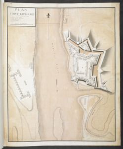
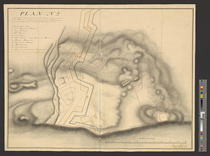
PLAN FORT EDWARD
8644.
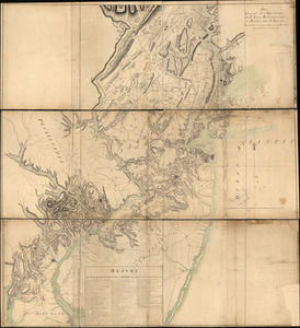
Plan from Paulus Hook ferry in the province of East Jersey, to King's Ferry in the province of New York and parts adjacent from...
8645.
Plan from St. Marys to St. Johns
8646.
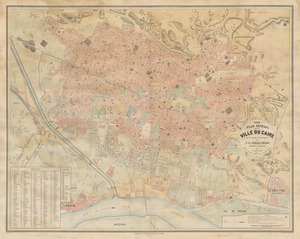
Plan general de la ville du Caire
8647.
Plan general des operations de l'Armée Britanique contre les rebelles dans l'Amerique : depuis l'arrivée des troupes...
8648.
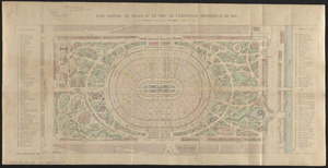
Plan général du palais et du parc de l'Exposition universelle de 1867
8649.
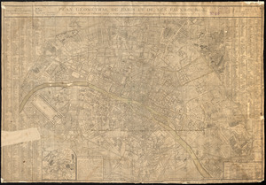
Plan géométral de Paris et de ses fauxbourgs
8650.
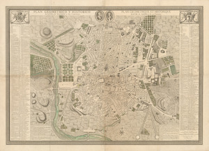
Plan geometrico y historico de la villa de Madrid y sus contornos = Plan geometrique et historique de la ville de Madrid et de...
8651.
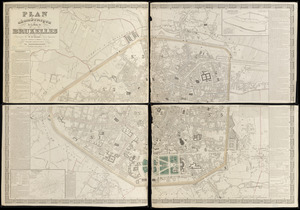
Plan géométrique de la ville de Bruxelles
8652.
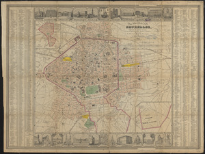
Plan illustré de la Ville de Bruxelles, comprenant les quartiers nouveaux & tous les agrandissements décrétés & projetés
8653.
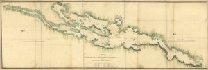
Plan, Lake Champlain from Fort St. John's to Ticonderoga : with the soundings, rocks, shoals, and sands, surveyed in the years...
8654.
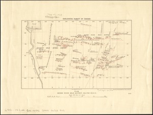
Plan Moose River gold district, Halifax Co., N.S
8655.
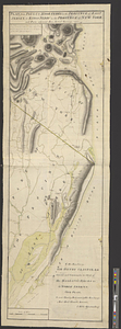
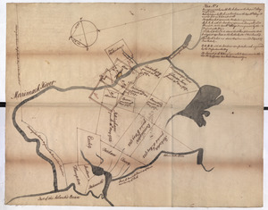
Plan No: 1 : [Eastern New Hampshire and Massachusetts]
8656.
Plan no. 1 of building lots near Spring St. Station West Roxbury belonging to the West Roxbury Land Co
8657.
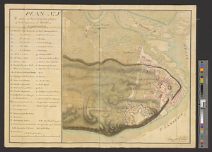
Plan (no. 1) To explain the report of the state of defence of the fortifications of Quebec
8658.
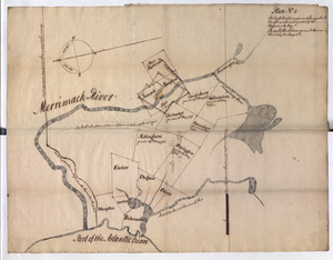
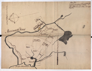
Plan No: 2 : [Eastern New Hampshire and Massachusetts]
8659.
Plan No: 2 : [Eastern New Hampshire and Massachusetts]
8660.
Plan (no. 2) shewing the ground whereon the citadel is proposed to be built : the ground lines of the present fortifications...
‹ Prev
Next ›
1
2
…
429
430
431
432
433
434
435
436
437
…
683
684