Plan geometrico y historico de la villa de Madrid y sus contornos = Plan geometrique et historique de la ville de Madrid et de ses environs
Item Information
- Title:
- Plan geometrico y historico de la villa de Madrid y sus contornos = Plan geometrique et historique de la ville de Madrid et de ses environs
- Description:
-
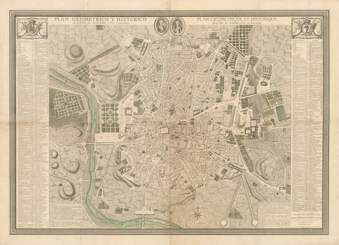
This map presents Madrid at the beginning of the reign of King Carlos III’s (r. 1759-88), after the improvements carried out by King Fernando VI (r. 1746-59). The medallions at the top depict Carlos III on the left and his son Carlos IV (r. 1788-1808). Carlos III unified Spain and created a national anthem along with the layout and colors of the national flag, still in use today. Carlos III also established Madrid as the capital city of Spain. The map is composed of four sheets; in a scale of 1:3,600. The legends in Spanish on the left and French on the right list many types of buildings including parishes, convents, chapels, churches, hospitals, schools, hermitages, prisons, hotels, and fountains. The Rio Manzanares and a number of new buildings can be found including the new Royal Palace constructed on the site of the former palace, destroyed by fire in 1734. The map also shows the Bridge of Toledo, finished in 1722, and the bullring, Plaza de Toros, opened in 1722.
- Cartographer:
- Chalmandrier, Nicolas
- Date:
-
1761
- Format:
-
Maps/Atlases
- Location:
- MacLean Collection Map Library
- Collection (local):
-
MacLean Collection Map Library
- Subjects:
-
Madrid (Spain)--Maps
- Places:
-
Comunidad de Madrid (region)Madrid (province)Madrid
- Extent:
- 1 map : color ; 101 cm x 143 cm
- Terms of Use:
-
Public Domain/No known restrictions on use. Contact host institution to download image.
Contact host institution for more information.
- Publisher:
-
Paris :
N. Chalmandrier
- Scale:
-
Scale [ca. 1:4,800]
- Language:
-
Spanish
French
- Notes:
-
Relief shown by hachures and pictorially.
Includes index.
Copper plate engraving.
- Identifier:
-
MacLeanColl_1989_Madrid
- Call #:
-
1989