Toggle navigation
LMEC Home
Exhibitions
Georeferencing
Tools for Teachers
Collections
My Favorites
Sign Up / Log In
Search
Search the map portal
Map Collection
Map Collection
Map Sets
Search
Search
Search for
Search In
All Fields
Creator
Title
Subject
Place
Search All Digital Collections
Advanced Search
13680 Results
My Search
Start Over
Date facet yearly ssim
1840
to
1844
Remove constraint Date facet yearly ssim: <span class='from'>1840</span> to <span class='to'>1844</span>
Filter your Search
Place
North and Central America
10,344
United States
8,475
Massachusetts
2,789
Suffolk (county)
1,677
Boston
1,633
Europe
1,415
Canada
950
New York
649
more
Place
»
Topic
Boston (Mass.)--Maps
747
City planning--Massachusetts--Boston--Maps
418
United States--History--Revolution, 1775-1783--Maps
329
United States--Maps
322
Real property--Massachusetts--Boston--Maps
254
Urban renewal--Massachusetts--Boston--Maps
254
Massachusetts--Maps
231
Insurance surveys
197
more
Topic
»
Date
Date range begin
–
Date range end
Current results range from
1482
to
2023
View distribution
Creator
United States. Hydrographic Office
597
Boston Redevelopment Authority
404
Des Barres, Joseph F. W. (Joseph Frederick Wallet), 1722-1824
247
Royal United Services Institute for Defence and Security Studies
160
Jefferys, Thomas, -1771
154
George, III, King of Great Britain, 1738-1820
152
George, IV, King of Great Britain, 1762-1830
151
O.H. Bailey & Co
148
more
Creator
»
Format
Maps/Atlases
13,499
Manuscripts
985
Prints
102
Books
49
Drawings/Illustrations
44
Photographs
15
Objects/Artifacts
13
Documents
7
more
Format
»
Georeferenced
Yes
979
No
12,701
Collection
Norman B. Leventhal Map & Education Center Collection
9,096
American Revolutionary War-Era Maps
3,305
Boston and New England Maps
2,915
Urban Maps
2,471
Maritime Charts and Atlases
1,169
William L. Clements Library Collection
910
Library of Congress Collection
618
Boston Redevelopment Authority Collection
475
more
Collection
»
Available to use
No known restrictions
10,246
Creative Commons license
1,678
Search Constraints
Sort by relevance
relevance
title
date (asc)
date (desc)
Number of results to display per page
20 per page
10
per page
20
per page
50
per page
100
per page
View results as:
grid view
map view
Search Results
8621.
Plan d'une partie de la rade de Boston pour faire connaitre le dispositif de ses deffenses
8622.
Plan d'York en Virginie avec les attaques faites par les Armées françoise et américaine en 8bre. 1781
8623.
PLAN E L'ELEVATION DU FORT S.T JEAN
8624.
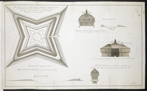
Plan Elevation and sections of Blockhouse to be built at Penobscot in the Bay of Funda to contain 100 Men or more if necessary....
8625.
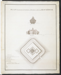
PLAN ELEVATION SECTION and PROFILE of ye ROYAL BLOCKHOUSE
8626.
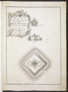
PLAN ELEVATION SECTION and PROFILE of ye ROYAL BLOCKHOUSE OPPOSITE FORT EDWARD
8627.
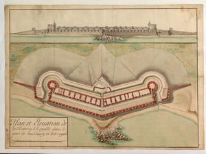
Plan et Elevation de la Batterie Royalle, dans le port de louisbourg, en l'isle royale
8628.
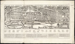
Plan et profil au naturel de la ville d'Orleans
8629.
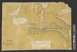
Plan figuratif du combat du 12 Avril 1782 entre l'armée angloise comandée par l'Amiral Rodney ... & l'armée Françoise commandée...
8630.
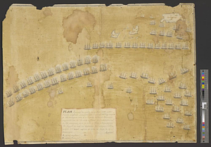
Plan figuratif du combat du 9 Avril 1782 entre l'armée anglaise comandée par l'amiral Rodney ... & l'armée Française commandée...
8631.
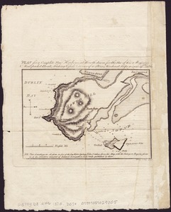
Plan for a complete new harbour, at Howth-town, for the use of his Majesty's mail packet-boats, fishing vessels & in case of a...
8632.
Plan for Boston
8633.
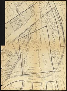
Plan for construction of a new city hall in Boston
8634.
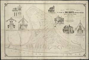
Plan for laying out the village of Oak Bluffs, Martha's Vineyard
8635.
[Plan for proposed Charles River Park]
8636.
Plan for the area around Rabbit Pond
8637.
Plan for the construction of improvements at the Boston Common
8638.
Plan for the diversion and enclosure of Stony Brook : to accompany report of W.H. Bradley, November 1864
8639.
Plan for the improvement of the Central Park, adopted by the Commissioners, June 3rd, 1856
8640.
Plan for the occupation of flats owned by the Commonwealth in Boston Harbor
‹ Prev
Next ›
1
2
…
428
429
430
431
432
433
434
435
436
…
683
684

![[Plan for proposed Charles River Park]](https://bpldcassets.blob.core.windows.net/derivatives/images/commonwealth:cf95jc91c/image_thumbnail_300.jpg)