Toggle navigation
LMEC Home
Exhibitions
Georeferencing
Tools for Teachers
Collections
My Favorites
Sign Up / Log In
Search
Search the map portal
Map Collection
Map Collection
Map Sets
Search
Search
Search for
Search In
All Fields
Creator
Title
Subject
Place
Search All Digital Collections
Advanced Search
13518 Results
My Search
Start Over
Date facet yearly ssim
1840
to
1844
Remove constraint Date facet yearly ssim: <span class='from'>1840</span> to <span class='to'>1844</span>
Filter your Search
Place
North and Central America
10,232
United States
8,367
Massachusetts
2,778
Suffolk (county)
1,675
Boston
1,631
Europe
1,386
Canada
949
New York
640
more
Place
»
Topic
Boston (Mass.)--Maps
746
City planning--Massachusetts--Boston--Maps
418
United States--History--Revolution, 1775-1783--Maps
329
United States--Maps
321
Real property--Massachusetts--Boston--Maps
254
Urban renewal--Massachusetts--Boston--Maps
254
Massachusetts--Maps
230
Insurance surveys
197
more
Topic
»
Date
Date range begin
–
Date range end
Current results range from
1482
to
2023
View distribution
Creator
United States. Hydrographic Office
596
Boston Redevelopment Authority
404
Des Barres, Joseph F. W. (Joseph Frederick Wallet), 1722-1824
247
Royal United Services Institute for Defence and Security Studies
160
Jefferys, Thomas, -1771
154
George, III, King of Great Britain, 1738-1820
152
George, IV, King of Great Britain, 1762-1830
151
O.H. Bailey & Co
148
more
Creator
»
Format
Maps/Atlases
13,337
Manuscripts
985
Prints
102
Books
49
Drawings/Illustrations
44
Photographs
15
Objects/Artifacts
13
Documents
7
more
Format
»
Georeferenced
Yes
979
No
12,539
Collection
Norman B. Leventhal Map & Education Center Collection
9,022
American Revolutionary War-Era Maps
3,305
Boston and New England Maps
2,900
Urban Maps
2,425
Maritime Charts and Atlases
1,167
William L. Clements Library Collection
910
Library of Congress Collection
618
Boston Redevelopment Authority Collection
475
more
Collection
»
Available to use
No known restrictions
10,085
Creative Commons license
1,677
Search Constraints
Sort by relevance
relevance
title
date (asc)
date (desc)
Number of results to display per page
20 per page
10
per page
20
per page
50
per page
100
per page
View results as:
grid view
map view
Search Results
8241.
The pictorial map, stamps of America
8242.
The pictorial map, stamps of the U.S.A.
8243.
The pictorial map, United States stamps
8244.
Pictorial plan of Chester
8245.
A pictorial stamp map of navigation and exploration
8246.
The picture map of France
8247.
Pierce County, Wis.
8248.
Pigeon Cove, Rockport, Essex County, Mass
8249.
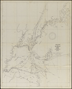
Pilot chart of New York Bay and Harbor for use with Krause's New York pilot courses
8250.
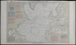
Pilot chart of the North Atlantic Ocean
8251.
Pilot chart of the South Pacific
8252.
Pittsburgh district
8253.
Pittsfield
8254.
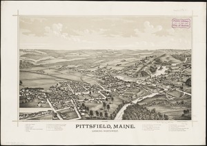
Pittsfield, Maine : looking northwest
8255.
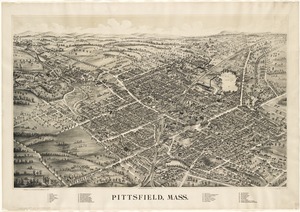
Pittsfield, Mass
8256.
Pittsfield, Merrimackcounty [sic], N.H : 1884
8257.
Pittsfield, Merrimackcounty [sic], N.H : 1884
8258.
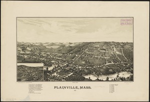
Plainville, Mass : 1887
8259.
A plan & profile of the Boston & Lowell Railroad
8260.
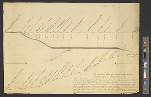
A plan & section of a survey taken April 20, 1801 on a new prepared course for the Middlesex Canal, from the south end of...
‹ Prev
Next ›
1
2
…
409
410
411
412
413
414
415
416
417
…
675
676


![Pittsfield, Merrimackcounty [sic], N.H](https://bpldcassets.blob.core.windows.net/derivatives/images/commonwealth:3f463513v/image_thumbnail_300.jpg)
![Pittsfield, Merrimackcounty [sic], N.H](https://bpldcassets.blob.core.windows.net/derivatives/images/commonwealth:x633fd276/image_thumbnail_300.jpg)