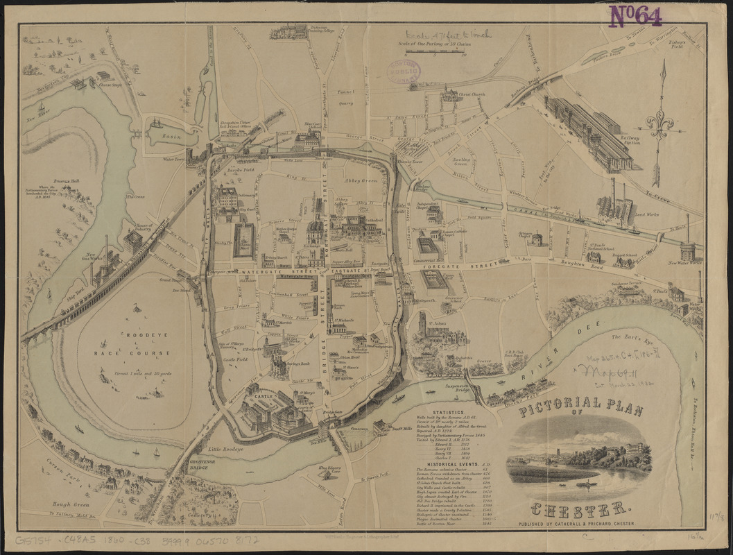
Pictorial plan of Chester
Item Information
- Title:
- Pictorial plan of Chester
- Publisher:
- Catherall and Prichard
- Engraver:
- Banks, William, -1866
- Date:
-
[1860?–1869?]
- Format:
-
Maps/Atlases
- Location:
-
Boston Public Library
Norman B. Leventhal Map & Education Center - Collection (local):
-
Norman B. Leventhal Map & Education Center Collection
- Subjects:
-
Chester (England)--Maps
- Places:
-
EnglandCheshire (county)Chester
- Extent:
- 1 map : color ; 31 x 41 cm
- Terms of Use:
-
No known copyright restrictions.
No known restrictions on use.
- Publisher:
-
Chester :
Catherall & Prichard
- Scale:
-
Scale approximately 1:5,750
- Language:
-
English
- Notes:
-
Relief shown pictorially.
Notable buildings shown pictorially.
Includes vignette of a river bend.
- Identifier:
-
06_01_015019
- Call #:
-
G5754.C48A5 1860 .C38
- Barcode:
-
39999065708172


