Toggle navigation
LMEC Home
Exhibitions
Georeferencing
Tools for Teachers
Collections
My Favorites
Sign Up / Log In
Search
Search the map portal
Map Collection
Map Collection
Map Sets
Search
Search
Search for
Search In
All Fields
Creator
Title
Subject
Place
Search All Digital Collections
Advanced Search
13518 Results
My Search
Start Over
Date facet yearly ssim
1685
to
1689
Remove constraint Date facet yearly ssim: <span class='from'>1685</span> to <span class='to'>1689</span>
Filter your Search
Place
North and Central America
10,232
United States
8,367
Massachusetts
2,778
Suffolk (county)
1,675
Boston
1,631
Europe
1,386
Canada
949
New York
640
more
Place
»
Topic
Boston (Mass.)--Maps
746
City planning--Massachusetts--Boston--Maps
418
United States--History--Revolution, 1775-1783--Maps
329
United States--Maps
321
Real property--Massachusetts--Boston--Maps
254
Urban renewal--Massachusetts--Boston--Maps
254
Massachusetts--Maps
230
Insurance surveys
197
more
Topic
»
Date
Date range begin
–
Date range end
Current results range from
1482
to
2023
View distribution
Creator
United States. Hydrographic Office
596
Boston Redevelopment Authority
404
Des Barres, Joseph F. W. (Joseph Frederick Wallet), 1722-1824
247
Royal United Services Institute for Defence and Security Studies
160
Jefferys, Thomas, -1771
154
George, III, King of Great Britain, 1738-1820
152
George, IV, King of Great Britain, 1762-1830
151
O.H. Bailey & Co
148
more
Creator
»
Format
Maps/Atlases
13,337
Manuscripts
985
Prints
102
Books
49
Drawings/Illustrations
44
Photographs
15
Objects/Artifacts
13
Documents
7
more
Format
»
Georeferenced
Yes
979
No
12,539
Collection
Norman B. Leventhal Map & Education Center Collection
9,022
American Revolutionary War-Era Maps
3,305
Boston and New England Maps
2,900
Urban Maps
2,425
Maritime Charts and Atlases
1,167
William L. Clements Library Collection
910
Library of Congress Collection
618
Boston Redevelopment Authority Collection
475
more
Collection
»
Available to use
No known restrictions
10,085
Creative Commons license
1,677
Search Constraints
Sort by relevance
relevance
title
date (asc)
date (desc)
Number of results to display per page
20 per page
10
per page
20
per page
50
per page
100
per page
View results as:
grid view
map view
Search Results
8101.
Paskaerte van de Zuÿdt en Noordt Revier in Nieu Nederlant streckende van Cabo Hinloopen tot Rechkewach
8102.
Paskaerte van Nova Granada en t'Eylandt California
8103.
Paskaerte Zÿnde de Noordelijckfte Zeekuften van America van Groenland door de Straet Davis en de Straet Hudson tot Terra Neuf
8104.
Passaic Cotton Mills "Rotch Dept." & "Penrod Dept.", New Bedford, Mass.
8105.
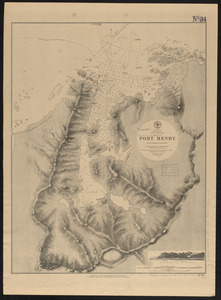
Patagonia w.c., Gulf of Trinidad, Port Henry : from a British survey in 1879
8106.
Patavinum Teritor = Territorio di Padova
8107.
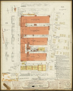
Patchogue-Plymouth Mills Corp., North Andover, Mass. [insurance map]
8108.
Path map of the eastern part of Mount Desert Island, Maine
8109.
Path map of the eastern part of Mount Desert Island, Maine
8110.
Path map of the eastern part of Mount Desert Island, Maine
8111.
Path map of the Eastern part of Mount Desert Island Maine
8112.
Path map of the eastern part of Mount Desert Island, Maine
8113.
Path map of the eastern part of Mount Desert Island, Maine
8114.
Path map of the eastern part of Mount Desert Island, Maine
8115.
Patterson Battery
8116.
Paul Revere's plan of the scene of the Boston Massacre : used at the trial of Capt. Preston and soldiers
8117.
Paul Sample's America, its soil
8118.
Paulus Hook
8119.
Paulus Hook and Bergen : surveyed and draughted from the 22d. to 29th June 1781
8120.
Pawtuxet, Rhode Island : 1890
‹ Prev
Next ›
1
2
…
402
403
404
405
406
407
408
409
410
…
675
676


![Patchogue-Plymouth Mills Corp., North Andover, Mass. [insurance map]](https://bpldcassets.blob.core.windows.net/derivatives/images/commonwealth:ww72bz24s/image_thumbnail_300.jpg)