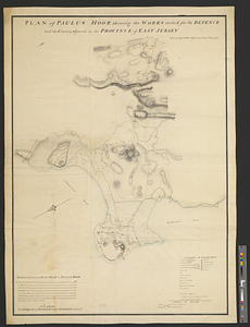
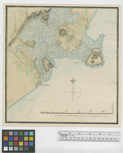
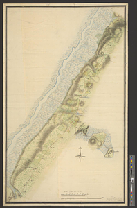
Paulus Hook and Bergen : surveyed and draughted from the 22d. to 29th June 1781
This map is also available in American Revolutionary Geographies Online (ARGO), a collections portal especially built for material relating to the American Revolutionary War Era. Visit ARGO to learn more about this item and explore the historical geography of North America in the late eighteenth century.
Item Information
- Title:
- Paulus Hook and Bergen : surveyed and draughted from the 22d. to 29th June 1781
- Creator:
- Nicole, Pierre, -1784
- Name on Item:
-
by P. Nicole
- Date:
-
June 1781
- Format:
-
Maps/Atlases
- Genre:
-
Manuscript maps
- Location:
- William L. Clements Library
- Collection (local):
-
William L. Clements Library Collection
- Subjects:
-
Paulus Hook (N.J.)--Maps
Bergen (Jersey City, N.J.)--Maps
Hackensack River (N.Y. and N.J.)--Maps
United States--History--Revolution, 1775-1783--Maps
- Places:
-
New JerseyHudson (county)Jersey City
Hackensack River
- Extent:
- 1 ms. map : col. ; 93.8 x 59.3 cm.
- Terms of Use:
-
The University of Michigan Library provides access to these materials for educational and research purposes. These materials may be under copyright. If you decide to use any of these materials, you are responsible for making your own legal assessment and securing any necessary permission. If you have questions about the collection, please contact the William L. Clements Library.
Contact host institution for more information.
- Scale:
-
Scale 1:12,000.
- Language:
-
English
- Catalog Record:
-
Catalog record
- Notes:
-
Finished, colored, topographical map of Paulus Hook, the vicinity of Bergen, and part of the valley of the Hackensack River.
Distances from Paulus Hook to different points along the main road are indicated.
Clinton Maps 217.
- Identifier:
-
8662
- Barcode:
-
B2668419