Toggle navigation
LMEC Home
Exhibitions
Georeferencing
Tools for Teachers
Collections
My Favorites
Sign Up / Log In
Search
Search the map portal
Map Collection
Map Collection
Map Sets
Search
Search
Search for
Search In
All Fields
Creator
Title
Subject
Place
Search All Digital Collections
Advanced Search
105 Results
My Search
Start Over
Date
2000
to
2022
Remove constraint Date: <span class='from'>2000</span> to <span class='to'>2022</span>
Filter your Search
Place
North and Central America
87
United States
86
Massachusetts
77
Boston
59
Suffolk (county)
59
World
8
Asia
5
Africa
3
more
Place
»
Topic
Boston (Mass.)--Maps
49
Immigrants--Massachusetts--Boston--Maps
17
Massachusetts--Maps
15
World maps
7
Climatic changes--Massachusetts--Boston--Maps
5
Sea level--Massachusetts--Boston--Maps
5
Hazardous waste sites--Massachusetts--Maps
4
Boston (Mass.)--Historical geography--Maps
3
more
Topic
»
Date
2000
to
2022
[remove]
105
Date range begin
–
Date range end
Current results range from
1990
to
2022
2000
to
2001
13
2002
to
2004
12
2005
to
2006
13
2007
to
2009
7
2010
to
2011
3
2012
to
2014
19
2015
to
2016
12
2017
to
2019
13
2020
to
2021
25
2022
to
2022
3
Creator
Boston Public Library. Norman B. Leventhal Map and Education Center
26
Boston Redevelopment Authority. Office of Digital Cartography & GIS
12
Boston Planning and Development Agency
9
Huffman, Daniel P.
9
United States. Central Intelligence Agency
9
Climate Ready Boston
5
Boston Public Library. Norman B. Leventhal Map Center
4
Hornblower, Belle
4
more
Creator
»
Format
Maps/Atlases
104
Books
1
Posters
1
Georeferenced
Yes
21
No
84
Collection
Norman B. Leventhal Map & Education Center Collection
101
Boston and New England Maps
46
Urban Maps
9
David Judkins Weaver Papers
4
Applied Geographics, Inc. Records
2
Lucius Beebe Memorial Library Historic Maps
2
Boston Redevelopment Authority Collection
1
Robert E. Diefenbach Map Collection at Phillips Academy
1
Available to use
No known restrictions
71
Creative Commons license
27
Search Constraints
Sort by relevance
relevance
title
date (asc)
date (desc)
Number of results to display per page
20 per page
10
per page
20
per page
50
per page
100
per page
View results as:
grid view
map view
Search Results
61.
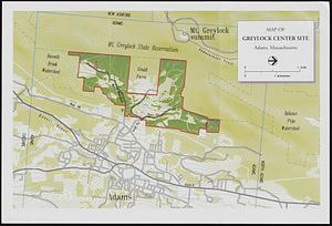
Map of Greylock center site, Adams, Massachusetts
62.
Map of public transportation routes in Greater Boston served by the Massachusetts Bay Transportation Authority comprising 64...
63.
Map of the countries near to the land of Oz
64.
Massachusetts official transportation map
65.
Massachusetts official transportation map
66.
Massachusetts Turnpike map : the main street of Massachusetts
67.
MBTA flood exposure : 36" SLR 2070s or later
68.
Mean travel time to work
69.
Metacomet-Monadnock Trail : an analysis of landuse
70.
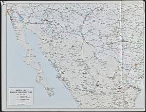
Mexico - US border infrastructure
71.
Most popular mode of commuting : 2014-2018 American Community Survey
72.
Nantucket
73.
Neighborhoods of Boston
74.
New England regional transportation map = Mapa do transporte regional da Nova Inglaterra = Nueva Inglaterra, mapa regional de...
75.
Open space 2017
76.
A people's map of Lawrence, Massachusetts
77.
The people's republic of Cambridge
78.
Percent foreign-born
79.
Peters World map
80.
Physical map of the world, April 2001
‹ Prev
Next ›
1
2
3
4
5
6