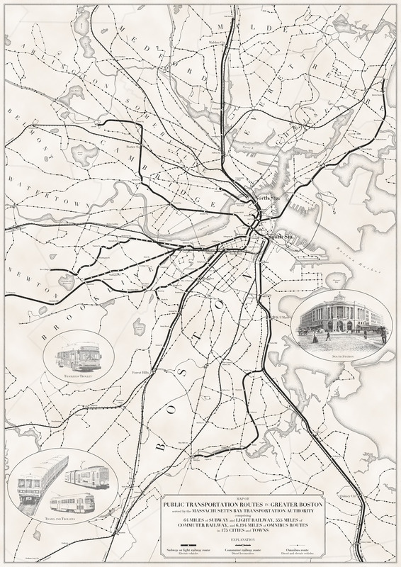
Map of public transportation routes in Greater Boston served by the Massachusetts Bay Transportation Authority comprising 64 miles of subway and light railway, 555 miles of commuter railway, and 6,194 miles of omnibus routes in 175 cities and towns
Item Information
- Title:
- Map of public transportation routes in Greater Boston served by the Massachusetts Bay Transportation Authority comprising 64 miles of subway and light railway, 555 miles of commuter railway, and 6,194 miles of omnibus routes in 175 cities and towns
- Cartographer:
- Woodruff, Andy
- Copyright holder:
- Boston Public Library. Norman B. Leventhal Map and Education Center
- Date:
-
2020
- Format:
-
Maps/Atlases
- Location:
-
Boston Public Library
Norman B. Leventhal Map & Education Center - Collection (local):
-
Norman B. Leventhal Map & Education Center Collection
- Subjects:
-
Local transit--Massachusetts--Boston--Maps
Boston (Mass.)--Maps
- Places:
-
MassachusettsSuffolk (county)Boston
- Extent:
- 1 map
- Terms of Use:
-
(c) Norman B. Leventhal Map & Education Center at the Boston Public Library
This work is licensed for use under a Creative Commons Attribution License (CC BY).

- Place of origin:
-
[Malden, Mass.]
- Language:
-
English
- Notes:
-
Shows subway or light rail, commuter rail and omnibus routes.
Includes illustrations of trackless trolley, trains and trolleys, and South Station.
- Notes (exhibitions):
-
Exhibited: "Bending lines: maps and data from distortion to deception," organized by the Norman B. Leventhal Map & Education Center at the Boston Public Library, 2020-2021.
- Identifier:
-
railmap


