Toggle navigation
LMEC Home
Exhibitions
Georeferencing
Tools for Teachers
Collections
My Favorites
Sign Up / Log In
Search
Search the map portal
Map Collection
Map Collection
Map Sets
Search
Search
Search for
Search In
All Fields
Creator
Title
Subject
Place
Search All Digital Collections
Advanced Search
134 Results
My Search
Start Over
1901
Remove constraint 1901
Filter your Search
Place
North and Central America
112
United States
79
Massachusetts
20
Cuba
12
Canada
9
New York
9
Boston
8
Hawaii
8
more
Place
»
Topic
United States--Maps
10
Havana (Cuba)--Maps
5
Coasts--Florida--Maps--Early works to 1800
4
Florida--Maps--Early works to 1800
4
Manuscript maps--Early works to 1800
4
Nautical charts--Florida--Early works to 1800
4
Roads--Cuba--Havana--Maps
4
Streets--Cuba--Havana--Maps
4
more
Topic
»
Date
Date range begin
–
Date range end
Current results range from
1696
to
1978
View distribution
Creator
United States. War Department
12
United States. Congress (56th, 2nd session : 1900-1901). Senate
10
United States. Congress. Senate. Committee on Foreign Relations
10
United States. Hydrographic Office
10
Enthoffer, J. (Joseph), 1818-1901
9
Colton, G. Woolworth (George Woolworth), 1827-1901
8
United States. Army. Department of Cuba
8
United States. Congress (56th, 2nd session : 1900-1901). House
8
more
Creator
»
Format
Maps/Atlases
131
Manuscripts
6
Prints
2
Documents
1
Georeferenced
Yes
12
No
122
Collection
Norman B. Leventhal Map & Education Center Collection
121
Maritime Charts and Atlases
13
Boston and New England Maps
10
Urban Maps
10
American Revolutionary War-Era Maps
7
Library of Congress Collection
6
David Judkins Weaver Papers
3
Ralph Finos Map Collection at Phillips Academy
2
more
Collection
»
Available to use
No known restrictions
125
Creative Commons license
7
Search Constraints
Sort by relevance
relevance
title
date (asc)
date (desc)
Number of results to display per page
20 per page
10
per page
20
per page
50
per page
100
per page
View results as:
grid view
map view
Search Results
61.
Plano del canal à Santa Ana en el camino de Matanzas á la Cidra
62.
Plano del estudio para el dragado de la entrada al Puerto de Cardenas
63.
Plano del estudio para el dragado de la entrada al Puerto de Cardenas sondas
64.
Plano general de los ferrocarriles de la Isla de Cuba
65.
Charles River Basin contour map of upper basin from surveys and soundings
66.
General map of the island of Maui : as surveyed to March 1st 1880
67.
Plano general de las carreteras que merecen atencion preferente
68.
A Plan of the city of New York
69.
Hydrographic map of Lake Monona, Dane Co., Wisconsin and of the adjacent topography
70.
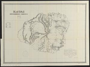
Kauai, government survey, 1878
71.
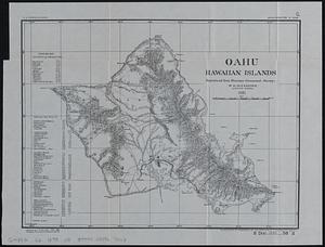
Oahu, Hawaiian Islands
72.
City of Boston Granary Burying Ground : Boston proper
73.
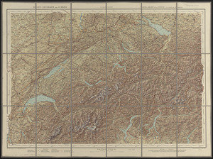
Relief-reisekarte der Schweiz = Carte-relief de la Suisse à l'usage des touristes
74.
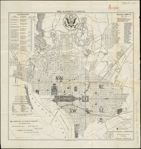
The nation's capital : [Washington D.C.]
75.
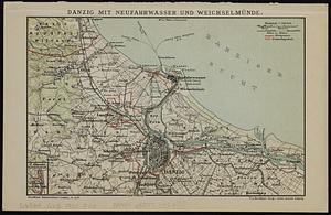
Danzig mit Neufahrwasser und Weichselmünde
76.
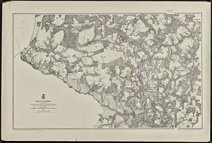
Cold Harbor
77.
Charles River, Boston Harbor, and the proposed Charles River basin : prepared to accompany report made to Henry L. Higginson,...
78.
Recentissima novi orbis, sive Americae Septentrionalis et Meridionalis tabula
79.
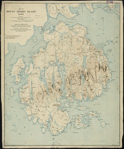
Map of Mount Desert Island, Maine
80.
Path map of the eastern part of Mount Desert Island, Maine
‹ Prev
Next ›
1
2
3
4
5
6
7