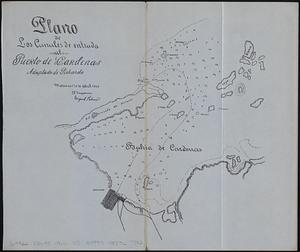
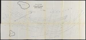
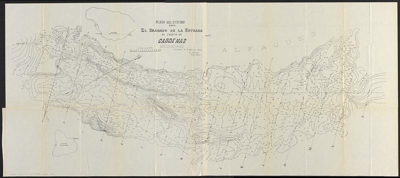
Plano del estudio para el dragado de la entrada al Puerto de Cardenas sondas
Item Information
- Title:
- Plano del estudio para el dragado de la entrada al Puerto de Cardenas sondas
- Issuing body:
- United States. War Department
- Issuing body:
- United States. Army. Department of Cuba
- Issuing body:
- United States. Congress (56th, 2nd session : 1900-1901). House
- Printer:
- United States. Government Printing Office
- Date:
-
[ca. 1902]
- Format:
-
Maps/Atlases
- Genre:
-
Bathymetric maps
- Location:
-
Boston Public Library
Norman B. Leventhal Map & Education Center - Collection (local):
-
Norman B. Leventhal Map & Education Center Collection
- Subjects:
-
Cárdenas Bay (Cuba)--Maps
- Places:
-
CubaMatanzas (province)Cárdenas, Bahía de (bay)
- Extent:
- 1 map ; 57 x 130 cm
- Terms of Use:
-
No known copyright restrictions.
No known restrictions on use.
- Publisher:
-
[Washington, D.C.] :
[United States House of Representatives]
- Scale:
-
Scale approximately 1:7,500
- Language:
-
Spanish
- Notes:
-
Depths shown by soundings and isolines.
Oriented with north to the upper right.
"Cardenas 30 de Abril de 1900, el ingeniero Miguel Palmer."
Map detached from Annual reports of the War Department for the fiscal year ended June 30, 1900. Part 12. Report of the Military Governor of Cuba on Civil Affairs (Washington : Government Printing Office, 1902).
- Identifier:
-
06_01_018409
- Call #:
-
G4922.C36C2 1900 .U5
- Barcode:
-
39999085966982