Hydrographic map of Lake Monona, Dane Co., Wisconsin and of the adjacent topography
Item Information
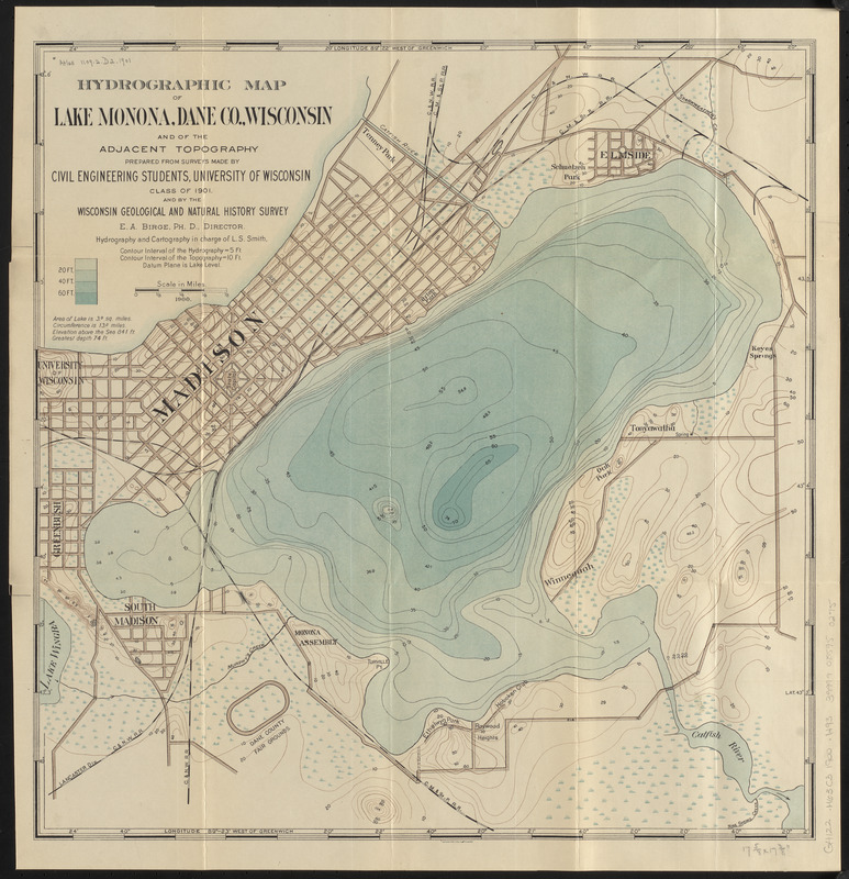
- Title:
- Hydrographic map of Lake Monona, Dane Co., Wisconsin and of the adjacent topography
- Title (alt.):
-
Hydrographic map of Lake Monona, Dane County, Wis. showing also the adjacent topography
- Cartographer:
- Smith, Leonard S. (Leonard Sewall), 1864-1947
- Publisher:
- Wisconsin Geological and Natural History Survey
- Contributor:
- University of Wisconsin. Department of Civil Engineering
- Printer:
- Northwestern Litho. Co.
- Name on Item:
-
prepared from surveys made by Civil Engineering Students, University of Wisconsin, Class of 1901, and by the Wisconsin Geological and Natural History Survey ; hydrography and cartography in charge of L.S. Smith
- Date:
-
1901
(created)
(c) 1900 (copyright)
- Format:
-
Maps/Atlases
- Location:
-
Boston Public Library
Norman B. Leventhal Map & Education Center - Collection (local):
-
Norman B. Leventhal Map & Education Center Collection
- Subjects:
-
Hydrology--Wisconsin--Monona, Lake--Maps
Monona, Lake (Wis.)--Maps
- Places:
-
WisconsinDane (county)Monona, Lake
- Extent:
- 1 map : color ; 44 x 44 cm, folded in cover 20 x 11 cm
- Terms of Use:
-
No known copyright restrictions.
No known restrictions on use.
- Publisher:
-
Madison, Wis. ; Milwaukee :
Wisconsin Geological and Natural History Survey ; Northwestern Litho. Co.
- Scale:
-
Scale approximately 1:15,500
- Language:
-
English
- Notes:
-
Relief shown by contours. Depths shown by hypsometric tints, bathymetric soundings and isolines.
At head of cover title: no. 10.
Explanation of map on inside of front cover.
Imprint from cover.
- Identifier:
-
06_01_016658
- Call #:
-
G4122.M63C3 1900 .H93
- Barcode:
-
39999085950275


