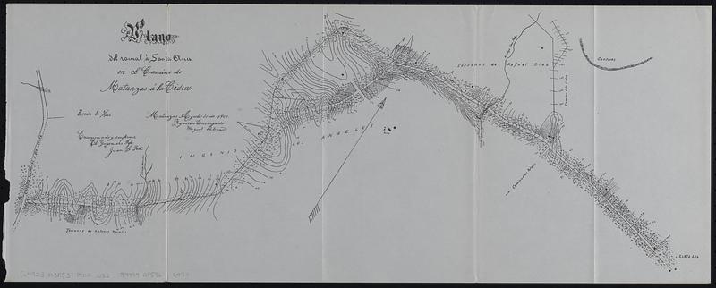
Plano del canal à Santa Ana en el camino de Matanzas á la Cidra
Item Information
- Title:
- Plano del canal à Santa Ana en el camino de Matanzas á la Cidra
- Issuing body:
- United States. War Department
- Issuing body:
- United States. Army. Department of Cuba
- Issuing body:
- United States. Congress (56th, 2nd session : 1900-1901). House
- Printer:
- United States. Government Printing Office
- Date:
-
[1902]
- Format:
-
Maps/Atlases
- Location:
-
Boston Public Library
Norman B. Leventhal Map & Education Center - Collection (local):
-
Norman B. Leventhal Map & Education Center Collection
- Subjects:
-
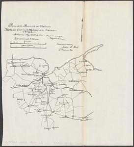
Matanzas (Cuba : Province)--Maps
Canals--Cuba--Matanzas (Province)--Maps
Roads--Cuba--Matanzas (Province)--Maps
- Places:
-
CubaMatanzas (province)
- Extent:
- 1 map ; 23 x 58 cm
- Terms of Use:
-
No known copyright restrictions.
No known restrictions on use.
- Publisher:
-
[Washington, D.C.] :
[Government Printing Office]
- Scale:
-
Scale 1:7,500
- Language:
-
Spanish
- Notes:
-
Relief shown by contours.
Oriented with north to the upper right.
"Matanzas Agosto 31 de 1900, ingeniero encargado Miguel Palmer. Examinado y conforme el ingeniero jefe Juan G Peoli."
Map detached from Annual reports of the War Department for the fiscal year ended June 30, 1900. Part 12. Report of the Military Governor of Cuba on Civil Affairs (Washington : Government Printing Office, 1902).
- Notes (date):
-
This date is inferred.
- Identifier:
-
06_01_018410
- Call #:
-
G4923.M3F53 1900 .U52
- Barcode:
-
39999085966974