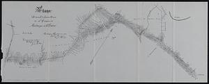
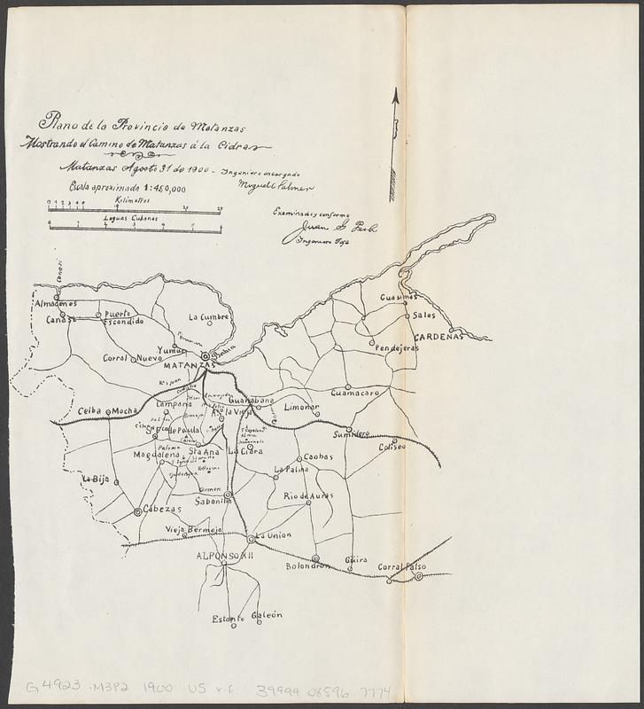
Plano de la provincia de Matanzas mostrando el camino de Matanzas á la Cidra
Item Information
- Title:
- Plano de la provincia de Matanzas mostrando el camino de Matanzas á la Cidra
- Issuing body:
- United States. War Department
- Issuing body:
- United States. Army. Department of Cuba
- Issuing body:
- United States. Congress (56th, 2nd session : 1900-1901). House
- Printer:
- United States. Government Printing Office
- Date:
-
[1902]
- Format:
-
Maps/Atlases
- Location:
-
Boston Public Library
Norman B. Leventhal Map & Education Center - Collection (local):
-
Norman B. Leventhal Map & Education Center Collection
- Subjects:
-
Matanzas (Cuba : Province)--Maps
Roads--Cuba--Matanzas (Province)--Maps
Railroads--Cuba--Matanzas (Province)--Maps
- Places:
-
CubaMatanzas (province)
- Extent:
- 1 map ; 23 x 21 cm
- Terms of Use:
-
No known copyright restrictions.
No known restrictions on use.
- Publisher:
-
[Washington, D.C.] :
[United States House of Representatives]; [Government Printing Office]
- Scale:
-
Scale approximately 1:450,000
- Language:
-
Spanish
- Notes:
-
Matanzas Agooto 31 de 1900, ingeniero encargado Miguel C Palmer. Examinado y conforme Juan G Peoli, ingeniero jefe.
Map detached from Annual reports of the War Department for the fiscal year ended June 30, 1900. Part 12. Report of the Military Governor of Cuba on Civil Affairs (Washington : Government Printing Office, 1902).
- Notes (date):
-
This date is inferred.
- Identifier:
-
06_01_018418
- Call #:
-
G4923.M3P2 1900 .U5
- Barcode:
-
39999085967774