Toggle navigation
LMEC Home
Exhibitions
Georeferencing
Tools for Teachers
Collections
My Favorites
Sign Up / Log In
Search
Search the map portal
Map Collection
Map Collection
Map Sets
Search
Search
Search for
Search In
All Fields
Creator
Title
Subject
Place
Search All Digital Collections
Advanced Search
2261 Results
My Search
Start Over
london
Remove constraint london
Filter your Search
Place
North and Central America
1,492
United States
943
Europe
363
Canada
347
North America
194
New York
129
Massachusetts
117
New England
104
more
Place
»
Topic
North America--Maps--Early works to 1800
137
Coasts--Nova Scotia--Maps
64
New England--Maps--Early works to 1800
57
United States--History--French and Indian War, 1754-1763--Maps
57
United States--History--French and Indian War, 1754-1763--Maps, Manuscript--Early works to 1800
56
United States--Maps--Early works to 1800
54
United States--History--Revolution, 1775-1783--Maps
40
Nova Scotia--Maps--Early works to 1800
39
more
Topic
»
Date
Date range begin
–
Date range end
Current results range from
1624
to
1999
View distribution
Creator
Des Barres, Joseph F. W. (Joseph Frederick Wallet), 1722-1824
242
Jefferys, Thomas, -1771
167
George, III, King of Great Britain, 1738-1820
149
George, IV, King of Great Britain, 1762-1830
148
Sayer, Robert, 1725-1794
115
Faden, William, 1749-1836
109
Moll, Herman, d. 1732
72
Robert Sayer and John Bennett (Firm)
57
more
Creator
»
Format
Maps/Atlases
2,219
Manuscripts
161
Prints
23
Drawings/Illustrations
15
Books
4
Objects/Artifacts
1
Georeferenced
Yes
137
No
2,124
Collection
American Revolutionary War-Era Maps
1,355
Norman B. Leventhal Map & Education Center Collection
1,305
Maritime Charts and Atlases
263
British Library Collection
163
William L. Clements Library Collection
160
Boston and New England Maps
152
Richard H. Brown Revolutionary War Map Collection at Mount Vernon
146
MacLean Collection Map Library
140
more
Collection
»
Available to use
No known restrictions
1,271
Creative Commons license
569
Search Constraints
Sort by relevance
relevance
title
date (asc)
date (desc)
Number of results to display per page
20 per page
10
per page
20
per page
50
per page
100
per page
View results as:
grid view
map view
Search Results
721.
Antwerp : or Anvers
722.
The archipelago of the East, being the Sunda, the Molucca, and Phillipps. Islands : the chief settlements of the Dutch in India...
723.
Bermudas
724.
Dominica
725.
A Map of New England & ye country adjacent, : extending northward to Quebec, & westward to Niagara, on Lake Ontario; shewing...
726.
A map of the discoveries made by the Russians on the North West coast of America
727.
A new and accurate map of North Carolina in North America
728.
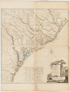
A new and general map of the Southern dominions belonging to the United States of America, viz North Carolina, South Carolina,...
729.
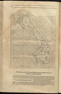
The peninsula and Gulf of Florida, or New Bahama Channel, : with the Bahama Island
730.
Sandwich Bay ... low water
731.
The south part of Great Britain, called England and Wales
732.
[Southwest coast of Nova Scotia from Cape Sable to Cape St. Mary]
733.
An Accurate map of the present seat of war between Great-Britain and her colonies in North America
734.
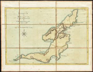
Bequia ou Becouya, le plus septentrionale des Granadilles : levé en 1763
735.
A chart of the world, according to Mercators projection, shewing the latest discoveries of Capt. Cook
736.
Map eleventh division railway mail service
737.
A map of South Carolina and a part of Georgia : Containing the whole sea-coast; all the islands, inlets, rivers, creeks,...
738.
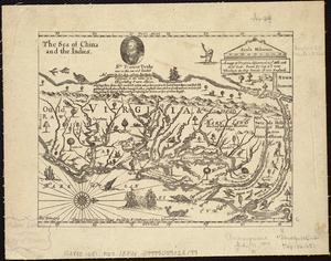
A mapp of Virginia discouered to ye hills, and in its latt: from 35 deg: & 1/2 neer Florida, to 41 deg: bounds of new England
739.
Sweden, Denmark, Norway and Finland : from the best authorities
740.
Dominica from an actual survey compleated in the year 1773
‹ Prev
Next ›
1
2
…
33
34
35
36
37
38
39
40
41
…
113
114


![[Southwest coast of Nova Scotia from Cape Sable to Cape St. Mary]](https://bpldcassets.blob.core.windows.net/derivatives/images/commonwealth:9g54xk749/image_thumbnail_300.jpg)