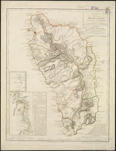
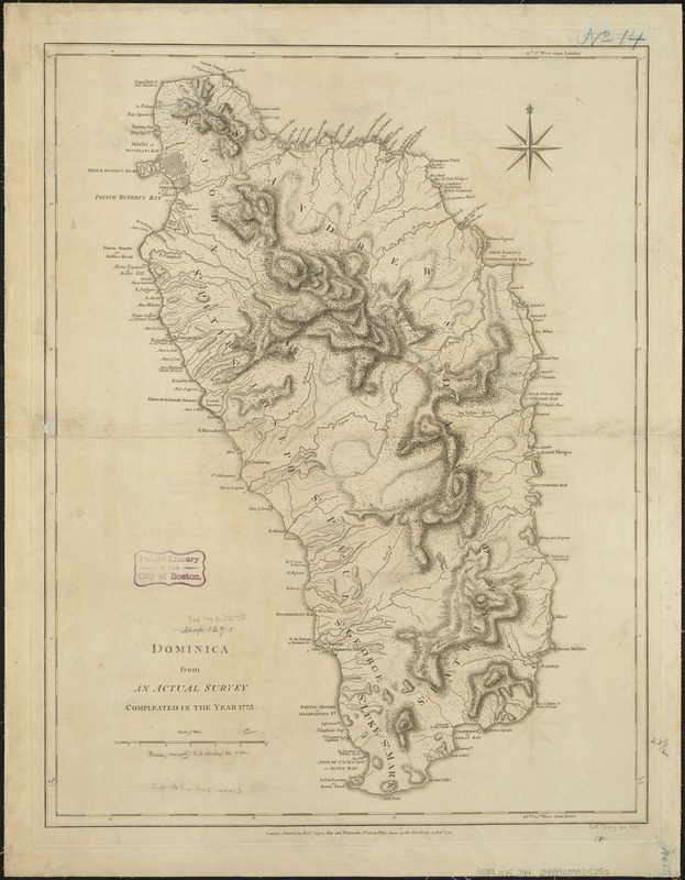
Dominica from an actual survey compleated in the year 1773
This map is also available in American Revolutionary Geographies Online (ARGO), a collections portal especially built for material relating to the American Revolutionary War Era. Visit ARGO to learn more about this item and explore the historical geography of North America in the late eighteenth century.
Item Information
- Title:
- Dominica from an actual survey compleated in the year 1773
- Creator:
- Jefferys, Thomas, d. 1771
- Date:
-
1775
- Format:
-
Maps/Atlases
- Location:
-
Boston Public Library
Norman B. Leventhal Map & Education Center - Collection (local):
-
Norman B. Leventhal Map & Education Center Collection
- Subjects:
-
Dominica--Maps--Early works to 1800
- Places:
-
Dominica
- Extent:
- 1 map ; 60 x 46 cm.
- Terms of Use:
-
No known copyright restrictions.
No known restrictions on use.
- Publisher:
-
London :
Printed for Robt. Sayer
- Scale:
-
Scale [ca. 1:85,000]
- Language:
-
English
- Notes:
-
Relief shown by hachures; depths by soundings.
Shows settlements, forested areas, hot springs, salt pans, parishes, Carib lands, anchorages, etc.
"Printed for Robt. Sayer, Map and Printseller, no. 53 in Fleet Street, as the Act directs 20 Feby. 1775."
Appears in the author's West-India atlas. London : Robert Sayer and John Bennett, 1783 [i.e. 1788].
Prime meridians: London and Ferro.
Cataloging, conservation, and digitization made possible in part by The National Endowment for the Humanities: Exploring the human endeavor.
- Identifier:
-
06_01_006378
- Call #:
-
G5100 1775 .J44
- Barcode:
-
39999059025252